Doles Lane
Doles Lane is a bus stop in Burnaston, South Derbyshire District, England. Doles Lane is situated nearby to Landown Farm Riding Stables, as well as near the village Findern.| Tap on a place to explore it |
Places of Interest Nearby
Highlights include Church of All Saints and Stenson Lock and attached bridge to east.
Church of All Saints
Church

Photo: Phil Myott, CC BY-SA 2.0.
Church of All Saints is situated 3,200 feet southeast of Doles Lane.
Stenson Lock and attached bridge to east
Lock

Photo: Roger Kidd, CC BY-SA 2.0.
Stenson Lock and attached bridge to east is situated 1½ miles southeast of Doles Lane.
Willington railway station
Railway station
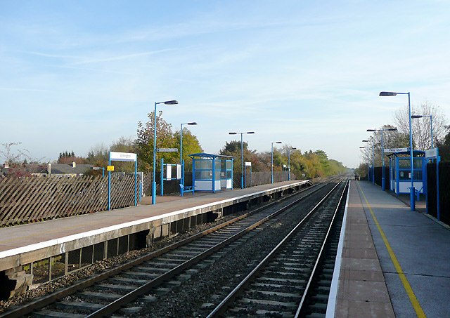
Photo: Roger Kidd, CC BY-SA 2.0.
Willington railway station serves the village of Willington in Derbyshire, England. The station is 6¼ miles south-west of Derby on the Cross Country Route. Willington railway station is situated 2 miles south of Doles Lane.
Places in the Area
Nearby places include Findern and Burnaston.
Findern
Village

Photo: moj palmer, CC BY-SA 2.0.
Findern is a village and civil parish in the District of South Derbyshire, approximately 5–6 miles south of Derby. The population of the civil parish was 1,669 at the 2011 Census.
Burnaston
Village

Photo: John Poyser, CC BY-SA 2.0.
Burnaston is a village and civil parish in the South Derbyshire district of Derbyshire, England. It is about 4.5 miles southwest of the city of Derby and has a population of 1,531.
Heatherton Village
Suburb
Heatherton Village is a residential area of Derby, England, located at the southern end of the village of Littleover, and approximately 3 miles south-west of Derby City Centre.
Doles Lane
- Type: Bus stop
- Category: transportation
- Location: Burnaston, South Derbyshire District, Derbyshire, East Midlands, England, United Kingdom, Britain and Ireland, Europe
- View on OpenStreetMap
Latitude
52.8786° or 52° 52′ 43″ northLongitude
-1.54923° or 1° 32′ 57″ westOpen location code
9C4WVFH2+C8OpenStreetMap ID
node 6620973570OpenStreetMap feature
highway=bus_stopOpenStreetMap feature
public_transport=platform
This page is based on OpenStreetMap, Wikidata, and Wikimedia Commons.
We’d love your help improving our open data sources. Thank you for contributing.
Satellite Map
Discover Doles Lane from above in high-definition satellite imagery.
Notable Places Nearby
Highlights include Landown Farm Riding Stables and Findern Recreation Ground (Hillside).
Nearby Places
Explore places such as Doles Lane and Burton Road.
Derbyshire: Must-Visit Destinations
Delve into Derby, Chesterfield, Matlock, and Buxton.
Curious Bus Stops to Discover
Uncover intriguing bus stops from every corner of the globe.
About Mapcarta. Data © OpenStreetMap contributors and available under the Open Database License". Text is available under the CC BY-SA 4.0 license, except for photos, directions, and the map. Photo: sidibousaid, CC BY 2.0.