Westbourne Catering Ltd
Westbourne Catering Ltd is in Wetherby, Leeds, England, and is located on Deighton Road. Westbourne Catering Ltd is situated nearby to the public building Masonic Hall, as well as near Sandringham Park.| Tap on a place to explore it |
Places of Interest Nearby
Highlights include St James’ Parish Church, Wetherby and Wetherby Town Hall.
St James’ Parish Church, Wetherby
Church
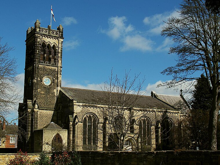
Photo: Stephen Craven, CC BY-SA 2.0.
St James' Parish Church is an Anglican parish church serving the parish of Wetherby with Linton in Wetherby, West Yorkshire, England. St James’ Parish Church, Wetherby is situated 1,300 feet southwest of Westbourne Catering Ltd.
Wetherby Town Hall
Town hall
 Wetherby Town Hall is a community building in Wetherby, West Yorkshire, England. The town hall no longer plays a major civic function but provides an office which is used by Wetherby Town Council and facilities for local groups and events. Wetherby Town Hall is situated 1,800 feet south of Westbourne Catering Ltd.
Wetherby’s Cinema
Movie theater

Photo: Mtaylor848, CC BY-SA 3.0.
Wetherby's Cinema, officially the Wetherby Film Theatre and formerly the Rodney Bingo Hall, Rodney Cinema and the Raby Picture House, is a cinema in Wetherby, West Yorkshire, England, that originally opened in April 1915. Wetherby’s Cinema is situated 1,800 feet southwest of Westbourne Catering Ltd.
Places in the Area
Nearby places include Ainsty and Micklethwaite.
Ainsty
Neighborhood

Photo: Mtaylor848, CC BY-SA 3.0.
Ainsty is an area of Wetherby, West Yorkshire, England. Ainsty is in the north of Wetherby and runs as far as the border between North and West Yorkshire, to the north of this is Kirk Deighton.
Micklethwaite
Neighborhood
Micklethwaite is an area of Wetherby, on the south bank of the River Wharfe, in the Leeds district, in the county of West Yorkshire, England. It was once a separate village but has been incorporated into Wetherby.
Ingmanthorpe
Hamlet

Photo: Stuart Cankett, CC BY-SA 2.0.
Ingmanthorpe is a hamlet close to the village of Kirk Deighton in North Yorkshire, England, the village is situated approximately 2 miles north of the town of Wetherby in neighbouring West Yorkshire.
Westbourne Catering Ltd
- Type: Catering
- Address: Deighton Road, Wetherby, LS22 7SZ
- Category: workshop
- Location: Wetherby, Leeds, England, United Kingdom, Britain and Ireland, Europe
- View on OpenStreetMap
Latitude
53.93305° or 53° 55′ 59″ northLongitude
-1.38368° or 1° 23′ 1″ westOpen location code
9C5WWJM8+6GOpenStreetMap ID
node 6638342615OpenStreetMap feature
craft=caterer
This page is based on OpenStreetMap, Wikidata, and Wikimedia Commons.
We’d love your help improving our open data sources. Thank you for contributing.
Satellite Map
Discover Westbourne Catering Ltd from above in high-definition satellite imagery.
Notable Places Nearby
Highlights include Masonic Hall and Sandringham Park.
Nearby Places
Explore places such as Deighton Road and Deighton Road York Road.
England: Must-Visit Destinations
Delve into London, Manchester, Sheffield, and Leeds.
Curious Places to Discover
Uncover intriguing places from every corner of the globe.
About Mapcarta. Data © OpenStreetMap contributors and available under the Open Database License". Text is available under the CC BY-SA 4.0 license, except for photos, directions, and the map. Photo: Mtaylor848, CC BY-SA 4.0.