Het Witte Dorp
Het Witte Dorp is a tram stop in Rotterdam, Rotterdam-The Hague Metropolitan Region, South Holland. Het Witte Dorp is situated nearby to the pier Watertaxi - Marconistraat / M4H, as well as near the square Damloperplein.| Tap on a place to explore it |
Places of Interest Nearby
Highlights include Sparta Stadion Het Kasteel and Domino’s.
Sparta Stadion Het Kasteel
Stadium
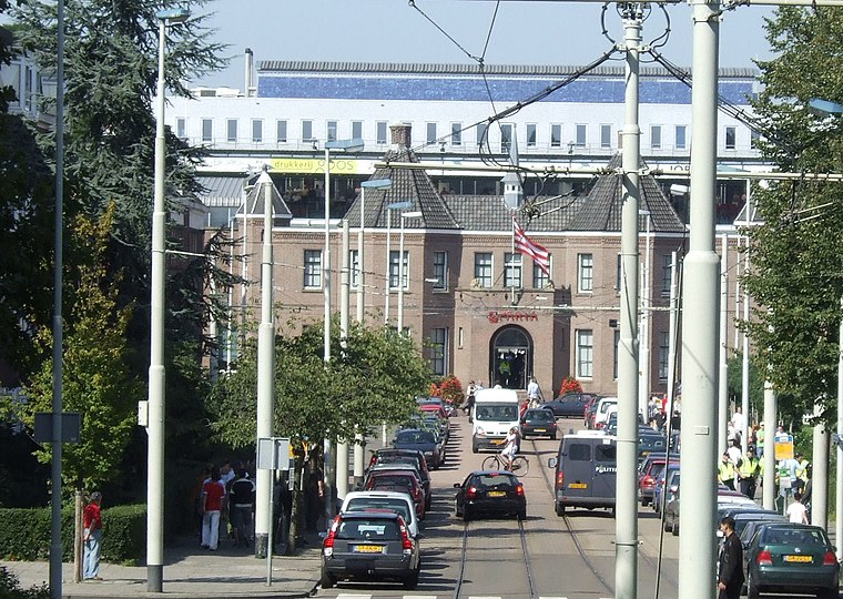
Photo: Hanhil, CC BY-SA 3.0.
The Sparta Stadion, nicknamed Het Kasteel, is a football stadium in Rotterdam, Netherlands. It is the home ground of Sparta Rotterdam. It has a capacity of 11,026. Sparta Stadion Het Kasteel is situated 1 km northeast of Het Witte Dorp.
Domino’s
Fast food restaurant

Photo: Michael Barera, CC BY-SA 4.0.
Domino's Pizza, Inc, commonly referred to as Domino's, is an American multinational pizza restaurant chain founded in 1960. The corporation is Delaware-domiciled and headquartered at the Domino's Farms office park in Ann Arbor Township, near Ann Arbor, Michigan. Domino’s is situated 1½ km west of Het Witte Dorp.
Floating Farm

Photo: Wikimedia, CC BY-SA 2.0.
Floating Farm is a floating dairy farm, described by its founders as the world's first, located in the harbour of Rotterdam. The farm produces fresh dairy products from 40 cows who live on the facility. Floating Farm is situated 680 metres west of Het Witte Dorp.
Places in the Area
Nearby places include Witte Dorp and Oud-Mathenesse.
Nieuw-Mathenesse
Quarter

Photo: Hanhil, CC BY-SA 3.0.
Nieuw-Mathenesse is a neighborhood of Rotterdam, Netherlands.
Het Witte Dorp
- Type: Tram stop
- Categories: railway stop, transport stop, and transportation
- Location: Rotterdam, Rotterdam-The Hague Metropolitan Region, South Holland, Western Netherlands, Netherlands, Benelux, Europe
- View on OpenStreetMap
Latitude
51.91352° or 51° 54′ 49″ northLongitude
4.42386° or 4° 25′ 26″ eastOperator
RETNetwork
Rail Rotterdam ConcessionOpen location code
9F36WC7F+CGOpenStreetMap ID
node 668984215OpenStreetMap feature
public_transport=stop_positionOpenStreetMap feature
railway=tram_stop
This page is based on OpenStreetMap, Wikidata, and Wikimedia Commons.
We’d love your help improving our open data sources. Thank you for contributing.
Satellite Map
Discover Het Witte Dorp from above in high-definition satellite imagery.
Notable Places Nearby
Highlights include Watertaxi - Marconistraat / M4H and Damloperplein.
Nearby Places
Explore places such as Rotterdam, Het Witte Dorp and Het Witte Dorp.
Rotterdam: Must-Visit Destinations
Delve into Centrum, Capelle en Noordoost, Albrandswaard, and Port of Rotterdam.
Curious Tram Stops to Discover
Uncover intriguing tram stops from every corner of the globe.
About Mapcarta. Data © OpenStreetMap contributors and available under the Open Database License". Text is available under the CC BY-SA 4.0 license, except for photos, directions, and the map. Photo: Wikimedia, CC BY 3.0.