Highfield Farm Stud
Highfield Farm Stud is a farm in Heathfield and Waldron, Wealden District, England. Highfield Farm Stud is situated nearby to the church St Bartholomew, as well as near the forest Holman’s Wood.| Tap on a place to explore it |
Places of Interest Nearby
Highlights include St Bartholomew and New Mill.
St Bartholomew
Church

Photo: The Voice of Hassocks, CC0.
St Bartholomew is a church, which is situated 1,600 feet north of Highfield Farm Stud.
New Mill
Windmill
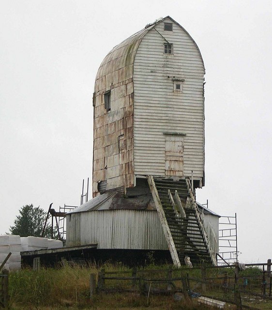
Photo: Wikimedia, CC BY-SA 2.0.
New Mill is a Grade II* listed post mill at Cross in Hand near Heathfield, East Sussex, England. It was the last windmill working commercially by wind in Sussex, ceasing work by wind in 1969 when a stock broke. New Mill is situated 4,000 feet northwest of Highfield Farm Stud.
St Richards Church
Church

Photo: Hassocks5489, CC0.
St Richards Church is situated 1¼ miles east of Highfield Farm Stud.
Places in the Area
Nearby places include Cross-in-Hand and Heathfield.
Cross-in-Hand
Village

Photo: nick macneill, CC BY-SA 2.0.
Cross-in-Hand is a small village outside Heathfield town to its west, in the Wealden District situated in East Sussex, England. It is occasionally referred to as Isenhurst.
Heathfield

Photo: Tom Morris, CC BY-SA 3.0.
Heathfield is a town in East Sussex, in the High Weald. This is an area of outstanding natural beauty. Situated near the Kentish border there are also excellent views of the South Downs and the coast in the south and marvellous views towards Mayfield and over Ashdown Forest.
Waldron
Village

Photo: Rog Frost, CC BY-SA 2.0.
Waldron is a village, which is situated 1½ miles southwest of Highfield Farm Stud.
Highfield Farm Stud
- Type: Farm
- Categories: locality and agriculture
- Location: Heathfield and Waldron, Wealden District, East Sussex, South East England, England, United Kingdom, Britain and Ireland, Europe
- View on OpenStreetMap
Latitude
50.96755° or 50° 58′ 3″ northLongitude
0.23146° or 0° 13′ 53″ eastOpen location code
9F22X69J+2HOpenStreetMap ID
node 6708566417OpenStreetMap feature
place=farm
This page is based on OpenStreetMap, Wikidata, and Wikimedia Commons.
We’d love your help improving our open data sources. Thank you for contributing.
Satellite Map
Discover Highfield Farm Stud from above in high-definition satellite imagery.
Notable Places Nearby
Highlights include Holman’s Wood and Heathfield Community Centre.
Nearby Places
Explore places such as New Pond Farm and The Firs Surgery.
East Sussex: Must-Visit Destinations
Delve into Brighton, Eastbourne, Hastings, and Lewes.
Curious Farms to Discover
Uncover intriguing farms from every corner of the globe.
About Mapcarta. Data © OpenStreetMap contributors and available under the Open Database License". Text is available under the CC BY-SA 4.0 license, except for photos, directions, and the map. Photo: matthewhartley369, CC BY-SA 2.0.