Costa’s Hairdressing
Costa’s Hairdressing is a hairdresser in Westminster, Greater London, England which is located on Harrow Road. Costa’s Hairdressing is situated nearby to the community center The Yaa Centre, as well as near St Peter’s CofE School.| Tap on a place to explore it |
Places of Interest Nearby
Highlights include London Paddington railway station and St Peter Elgin Avenue.
London Paddington railway station
Railway station

Photo: TheFrog001, CC0.
London Paddington is a main line and tube station complex on Praed Street, Paddington, London, which has been the main terminus for the Great Western Railway and successors since 1838. London Paddington railway station is situated 1 mile southeast of Costa’s Hairdressing.
St Peter Elgin Avenue
Church

Photo: Alexander P Kapp, CC BY-SA 2.0.
St Peter Elgin Avenue is a church, which is situated 880 feet north of Costa’s Hairdressing.
Westbourne Park tube station
Metro station

Photo: TheFrog001, CC0.
Westbourne Park is a London Underground station. It is located in the Notting Hill area of the Royal Borough of Kensington and Chelsea. The station is on the Circle and Hammersmith & City lines, between Ladbroke Grove and Royal Oak stations. Westbourne Park tube station is situated 1,500 feet southwest of Costa’s Hairdressing.
Places in the Area
Nearby places include Westbourne Green and Maida Hill.
Westbourne Green
Neighborhood
Westbourne Green is an area of Westbourne, London, the centre of the former hamlet of Westbourne, at the north-western corner of the City of Westminster.
Maida Hill
Suburb
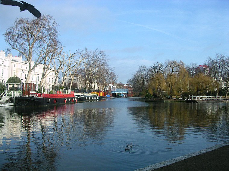
Photo: Charlesdrakew, Public domain.
Maida Vale is an affluent residential district in Central London, England, north of Paddington, southwest of St John's Wood and south of Kilburn, on Edgware Road.
Little Venice
Locality

Photo: Matthias v.d. Elbe, CC BY-SA 4.0.
Little Venice is an affluent residential district in North West London, England, around the junction of the Paddington Arm of the Grand Union Canal, the Regent's Canal, and the entrance to Paddington Basin.
Costa’s Hairdressing
- Type: Hairdresser
- Address: 372 Harrow Road, London
- Category: shop
- Location: Westminster, Greater London, London, England, United Kingdom, Britain and Ireland, Europe
- View on OpenStreetMap
Latitude
51.52328° or 51° 31′ 24″ northLongitude
-0.19575° or 0° 11′ 45″ westOpen location code
9C3XGRF3+8POpenStreetMap ID
node 6743935999OpenStreetMap feature
shop=hairdresser
This page is based on OpenStreetMap, Wikidata, and Wikimedia Commons.
We’d love your help improving our open data sources. Thank you for contributing.
Satellite Map
Discover Costa’s Hairdressing from above in high-definition satellite imagery.
Notable Places Nearby
Highlights include The Yaa Centre and St Peter’s CofE School.
Nearby Places
Explore places such as Pars Persian Cuisine and Foundation Estates.
London: Must-Visit Destinations
Delve into South Kensington-Chelsea, Heathrow Airport, City of London, and South London.
Curious Hairdressers to Discover
Uncover intriguing hairdressers from every corner of the globe.
About Mapcarta. Data © OpenStreetMap contributors and available under the Open Database License". Text is available under the CC BY-SA 4.0 license, except for photos, directions, and the map. Photo: Pablo BM, CC BY 2.0.