Busstop with shelter
Busstop with shelter is a bus stop in Santo Espírito, Vila do Porto Municipality. Busstop with shelter is situated nearby to the cemetery Cemitério de Santo Espírito, as well as near Church of Nossa Senhora da Purificação.| Tap on a place to explore it |
Places of Interest Nearby
Highlights include Church of Nossa Senhora da Purificação and Aveiro waterfall.
Church of Nossa Senhora da Purificação
Church

Photo: Carlos Luis M C da Cruz, Public domain.
Church of Nossa Senhora da Purificação is situated 140 metres east of Busstop with shelter.
Aveiro waterfall
Waterfall
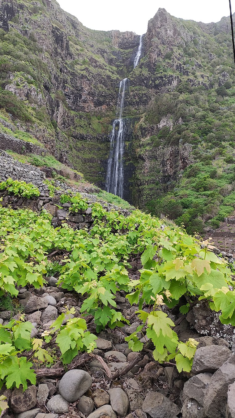
Photo: Armando Pacheco, CC BY-SA 4.0.
Aveiro waterfall is situated 2 km southeast of Busstop with shelter.
Gonçalo Velho Lighthouse
Lighthouse

Photo: Carlos Luis M C da Cruz, Public domain.
Gonçalo Velho Lighthouse is situated 4 km southeast of Busstop with shelter.
Busstop with shelter
- Type: Bus stop
- Also known as: “TSM busstop”
- Category: transportation
- Location: Santo Espírito, Vila do Porto Municipality, Azores, Portugal, Iberia, Europe
- View on OpenStreetMap
Latitude
36.95588° or 36° 57′ 21″ northLongitude
-25.04285° or 25° 2′ 34″ westOpen location code
898PXX44+8VOpenStreetMap ID
node 6744136786OpenStreetMap feature
highway=bus_stop
This page is based on OpenStreetMap, Wikidata, and Wikimedia Commons.
We’d love your help improving our open data sources. Thank you for contributing.
Satellite Map
Discover Busstop with shelter from above in high-definition satellite imagery.
In Other Languages
“Busstop with shelter” goes by many names.
- Hungarian: “Buszmegallo menedekkel”
Places with the Same Name
Discover other places named “Busstop with shelter”.
Notable Places Nearby
Highlights include Cemitério de Santo Espírito and Santa Maria Museum.
Nearby Places
Explore places such as Minimarket and Riac.
Azores: Must-Visit Destinations
Delve into Terceira, Ponta Delgada, Angra do Heroísmo, and Pico.
Curious Bus Stops to Discover
Uncover intriguing bus stops from every corner of the globe.
About Mapcarta. Data © OpenStreetMap contributors and available under the Open Database License". Text is available under the CC BY-SA 4.0 license, except for photos, directions, and the map. Photo: Tsy1980, CC BY-SA 4.0.