De Dreven
De Dreven is a neighborhood in Assen, Drenthe. De Dreven is situated nearby to the quarter Marsdijk, as well as near the neighborhood De Beemden.| Tap on a place to explore it |
Places of Interest
Highlights include Stadion Marsdijk and Drents Museum.

Drents Museum
Museum

Photo: CrazyPhunk, CC BY-SA 3.0.
The Drents Museum is an art and history museum in Assen, Drenthe, the Netherlands. Opened in 1854, it has a collection of prehistoric artifacts, applied art and visual art, as well as temporary exhibitions. In 2023, it had 179,345 visitors. Drents Museum is situated 3½ km southwest of De Dreven.
Assen railway station
Railway station
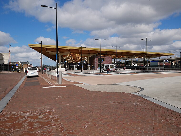
Photo: Fantaglobe11, CC BY-SA 4.0.
Assen is a railway station located in Assen, Netherlands. The station was opened on 1 May 1870 and is located on the Meppel–Groningen railway. The station is operated by Nederlandse Spoorwegen. Assen railway station is situated 3½ km south of De Dreven.
Places in the Area
Nearby places include Loon and Ter Aard.
Loon
Village
Loon is a village in the Netherlands and is part of the Assen municipality in Drenthe. The hunebed D15 is located near the village.
Ter Aard
Hamlet

Photo: G. Oosterveen, CC BY-SA 4.0.
Ter Aard is a hamlet in the Netherlands and is part of the Assen municipality in Drenthe. Ter Aard is a statistical entity, and has its own postal code, however it is considered a part of Zeijen. Ter Aard is situated 2½ km west of De Dreven.
Taarlo
Village

Photo: Gouwenaar, Public domain.
Taarlo is a village in the Dutch province of Drenthe. It is a part of the municipality of Tynaarlo, and lies about 5 km northeast of Assen. The village was first mentioned in 820 as Arlo. Taarlo is situated 3 km northeast of De Dreven.
De Dreven
- Type: Neighborhood
- Category: locality
- Location: Assen, Drenthe, Northern Netherlands, Netherlands, Benelux, Europe
- View on OpenStreetMap
Latitude
53.02156° or 53° 1′ 18″ northLongitude
6.58592° or 6° 35′ 9″ eastOpen location code
9F582HCP+J9OpenStreetMap ID
node 6805118120OpenStreetMap feature
place=neighbourhoodWikidata ID
Q116206792
This page is based on OpenStreetMap, Wikidata, and Wikimedia Commons.
We’d love your help improving our open data sources. Thank you for contributing.
Satellite Map
Discover De Dreven from above in high-definition satellite imagery.
In Other Languages
“De Dreven” goes by many names.
- Dutch: “De Dreven”
Places with the Same Name
Discover other places named “De Dreven”.
Localities in the Area
Explore places such as Marsdijk and De Kleuven.
Notable Places Nearby
Highlights include Anne Frankplantsoen and De Dissel.
Drenthe: Must-Visit Destinations
Delve into Hoogeveen, Meppel, Coevorden, and Aa en Hunze.
Curious Neighborhoods to Discover
Uncover intriguing neighborhoods from every corner of the globe.
About Mapcarta. Data © OpenStreetMap contributors and available under the Open Database License". Text is available under the CC BY-SA 4.0 license, except for photos, directions, and the map. Photo: Elgaard, CC BY-SA 3.0.