Halwyn Close
Halwyn Close is a bus stop in Feock, Cornwall, England. Halwyn Close is situated nearby to Carnon Downs Post Office, as well as near the forest Jubilee Wood.| Tap on a place to explore it |
Places of Interest Nearby
Highlights include Church of Saint John and Saint Petroc and Perranwell railway station.
Church of Saint John and Saint Petroc
Church
 Church of Saint John and Saint Petroc is situated 3,400 feet south of Halwyn Close.
Perranwell railway station
Railway station
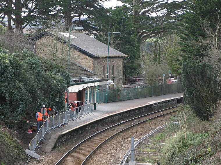
Photo: Geof Sheppard, CC BY-SA 4.0.
Perranwell station is on the Maritime Line between Truro and Falmouth Docks in Cornwall, England. The station is managed by, and the services are operated by, Great Western Railway. Perranwell railway station is situated 1 mile west of Halwyn Close.
The Punch Bowl And Ladle Inn
Pub
 The Punch Bowl And Ladle Inn is a pub, which is situated 1¼ miles east of Halwyn Close.
Places in the Area
Nearby places include Carnon Downs and Penelewey.
Carnon Downs
Village

Photo: Tony Atkin, CC BY-SA 2.0.
Carnon Downs is a village in Cornwall, England, United Kingdom. It is about three miles southwest of Truro on the A39 Truro to Falmouth road. Carnon Downs is in the civil parish of Feock, and consists mostly of bungalows, and detached housing built in the latter half of the 20th century.
Penelewey
Hamlet

Photo: Rod Allday, CC BY-SA 2.0.
Penelewey is a hamlet southeast of Playing Place in Cornwall, England, UK. Penelewey is on the B3289 road.
Playing Place
Village
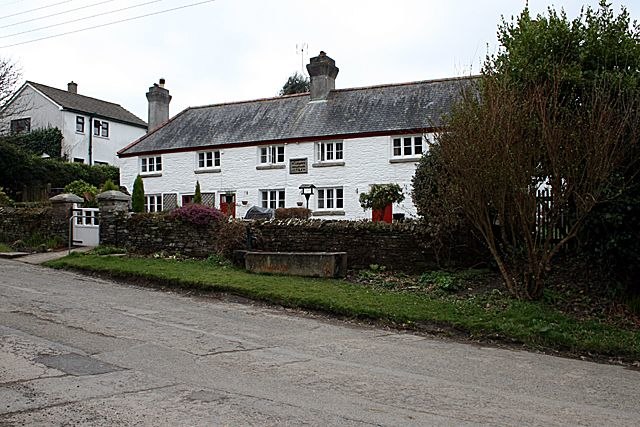
Photo: Fred James, CC BY-SA 2.0.
Playing Place is a village southwest of Truro, Cornwall, England. It is to the east of the A39 road. The name derives from Cornish 'plain an gwarry', an open-air performance area used historically for entertainment and instruction.
Halwyn Close
- Type: Bus stop
- Category: transportation
- Location: Feock, Cornwall, West Country, England, United Kingdom, Britain and Ireland, Europe
- View on OpenStreetMap
Latitude
50.22057° or 50° 13′ 14″ northLongitude
-5.08833° or 5° 5′ 18″ westOpen location code
9C2P6WC6+6MOpenStreetMap ID
node 682276998OpenStreetMap feature
highway=bus_stopOpenStreetMap feature
public_transport=platform
This page is based on OpenStreetMap, Wikidata, and Wikimedia Commons.
We’d love your help improving our open data sources. Thank you for contributing.
Satellite Map
Discover Halwyn Close from above in high-definition satellite imagery.
Notable Places Nearby
Highlights include Carnon Downs Post Office and Jubilee Wood.
Nearby Places
Explore places such as Costcutters and Spar.
Cornwall: Must-Visit Destinations
Delve into Truro, Penzance, Falmouth, and Land’s End.
Curious Bus Stops to Discover
Uncover intriguing bus stops from every corner of the globe.
About Mapcarta. Data © OpenStreetMap contributors and available under the Open Database License". Text is available under the CC BY-SA 4.0 license, except for photos, directions, and the map. Photo: ramsd, CC BY 2.0.