Burgberg - Reste des Ringwalls
Burgberg - Reste des Ringwalls is an archaeological site in Kordel, Trier-Saarburg, Rhineland-Palatinate. Burgberg - Reste des Ringwalls is situated nearby to the stone Gedenktafel für Förster Herbert Günther, as well as near the peak Brandenberg.| Tap on a place to explore it |
Places of Interest Nearby
Highlights include Churches in Kordel and Zemmer Observation Tower.
Churches in Kordel
Church
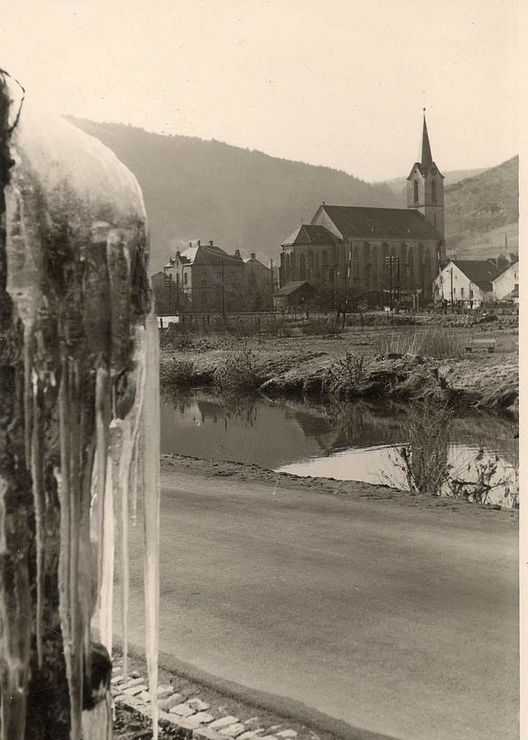
Photo: CTHOE, CC BY-SA 3.0.
Churches in Kordel is situated 1½ km south of Burgberg - Reste des Ringwalls.
Zemmer Observation Tower
Scenic viewpoint

Photo: Muck50, CC BY-SA 4.0.
Zemmer Observation Tower is a scenic viewpoint, which is situated 3 km northeast of Burgberg - Reste des Ringwalls.
Ramstein Castle
Castle

Photo: Brbbl, CC BY-SA 3.0.
The ruins of Ramstein Castle stand on a 182-metre-high, Bunter sandstone rock on the edge of the Meulenwald forest in the lower, steep-sided Kyll valley near Kordel in the German state of Rhineland-Palatinate. Ramstein Castle is situated 3½ km south of Burgberg - Reste des Ringwalls.
Places in the Area
Nearby places include Hosten and Idesheim.
Hosten
Village

Photo: CTHOE, CC BY-SA 4.0.
Hosten is a municipality in the district of Bitburg-Prüm, in Rhineland-Palatinate, western Germany. Hosten is situated 4½ km northwest of Burgberg - Reste des Ringwalls.
Idesheim
Village

Photo: Palauenc05, CC BY-SA 4.0.
Idesheim is a municipality in the district of Bitburg-Prüm, in Rhineland-Palatinate, western Germany. Idesheim is situated 5 km northwest of Burgberg - Reste des Ringwalls.
Auw an der Kyll
Village

Photo: Heckos89, CC BY-SA 3.0.
Auw an der Kyll is a municipality in the district of Bitburg-Prüm, in Rhineland-Palatinate, western Germany. Auw an der Kyll is situated 6 km north of Burgberg - Reste des Ringwalls.
Burgberg - Reste des Ringwalls
- Type: Archaeological site
- Categories: historic site, tourist attraction, and tourism
- Location: Kordel, Trier-Saarburg, Rhineland-Palatinate, Germany, Central Europe, Europe
- View on OpenStreetMap
Latitude
49.85497° or 49° 51′ 18″ northLongitude
6.64375° or 6° 38′ 38″ eastOpen location code
8FX8VJ3V+XFOpenStreetMap ID
node 6832926400OpenStreetMap feature
historic=archaeological_site
This page is based on OpenStreetMap, Wikidata, and Wikimedia Commons.
We’d love your help improving our open data sources. Thank you for contributing.
Satellite Map
Discover Burgberg - Reste des Ringwalls from above in high-definition satellite imagery.
Notable Places Nearby
Highlights include Burg-Berg and Gedenktafel für Förster Herbert Günther.
Nearby Places
Explore places such as Hunenkreuz and Froschley-Hütte.
Rhineland-Palatinate: Must-Visit Destinations
Delve into Mainz, Trier, Koblenz, and Worms.
Curious Archaeological Sites to Discover
Uncover intriguing archaeological sites from every corner of the globe.
About Mapcarta. Data © OpenStreetMap contributors and available under the Open Database License". Text is available under the CC BY-SA 4.0 license, except for photos, directions, and the map. Photo: Traveler100, CC BY-SA 3.0.