West Shipley Farm
West Shipley Farm is a farm in South Bedburn, County Durham, England. West Shipley Farm is situated nearby to the archaeological site ‘The Castles’ (camp), as well as near the forest Burnlea Row Wood.| Tap on a place to explore it |
Places of Interest Nearby
Highlights include Harperley POW Camp 93 and Hamsterley Baptist Chapel.
Harperley POW Camp 93
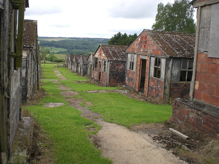
Photo: Rolyat29, CC BY-SA 3.0.
Harperley POW Camp 93 is a surviving purpose-built World War II Prisoner of War camp built to accommodate up to 1,400 inmates at Fir Tree near Crook, County Durham in the northeast of England. Harperley POW Camp 93 is situated 2 miles northeast of West Shipley Farm.
Hamsterley Baptist Chapel
Church

Photo: Hugh Mortimer, CC BY-SA 2.0.
Hamsterley Baptist Chapel is a church, which is situated 1½ miles southeast of West Shipley Farm.
Bradley Hall fortified house and underground passages, moated site, pillow mound and fishponds
Ruins

Photo: Les Hull, CC BY-SA 2.0.
Bradley Hall fortified house and underground passages, moated site, pillow mound and fishponds is a ruins, which is situated 1½ miles north of West Shipley Farm.
Places in the Area
Nearby places include Bedburn and Hamsterley.
Bedburn
Locality

Photo: David Hawgood, CC BY-SA 2.0.
Bedburn is a village in County Durham, in England. It is in the civil parish of South Bedburn, near Hamsterley, and Hamsterley Forest. The Bedburn Beck a tributary of the River Wear, flows past the village.
Hamsterley
Village
Hamsterley is a village in County Durham, England. It is situated a few miles west of Bishop Auckland. The village lies on a rise above the upper reaches of the Wear valley. Hamsterley is situated 1½ miles southeast of West Shipley Farm.
Fir Tree
Village

Photo: Oliver Dixon, CC BY-SA 2.0.
Fir Tree is a village in County Durham, in England. It is west of Crook, near the River Wear. Fir Tree has a petrol station and two pubs: The Duke of York and The Fir Tree Country Hotel. Fir Tree is situated 2½ miles east of West Shipley Farm.
West Shipley Farm
- Type: Farm
- Categories: locality and agriculture
- Location: South Bedburn, County Durham, North East England, England, United Kingdom, Britain and Ireland, Europe
- View on OpenStreetMap
Latitude
54.69612° or 54° 41′ 46″ northLongitude
-1.84068° or 1° 50′ 26″ westOpen location code
9C6WM5W5+CPOpenStreetMap ID
node 6887231821OpenStreetMap feature
place=farm
This page is based on OpenStreetMap, Wikidata, and Wikimedia Commons.
We’d love your help improving our open data sources. Thank you for contributing.
Satellite Map
Discover West Shipley Farm from above in high-definition satellite imagery.
Notable Places Nearby
Highlights include ‘The Castles’ (camp) and Burnlea Row Wood.
Nearby Places
Explore places such as Lane End and Fell.
County Durham: Must-Visit Destinations
Delve into Durham, Darlington, Hartlepool, and Stockton-on-Tees.
Curious Farms to Discover
Uncover intriguing farms from every corner of the globe.
About Mapcarta. Data © OpenStreetMap contributors and available under the Open Database License". Text is available under the CC BY-SA 4.0 license, except for photos, directions, and the map. Photo: Roberto Strauss, CC BY 2.0.