Departamento La Perla 619
Departamento La Perla 619 is a residential area in General Pueyrredón Partido, Buenos Aires which is located on Avenida Independencia. Departamento La Perla 619 is situated nearby to the park Plazoleta Ing. Carlos Maria Della Paolera (del Urbanismo), as well as near Plazoleta Alfonsina Storni.| Tap on a place to explore it |
Places of Interest Nearby
Highlights include Mar del Plata railway and bus station and Casino Central.
Mar del Plata railway and bus station
Railway station
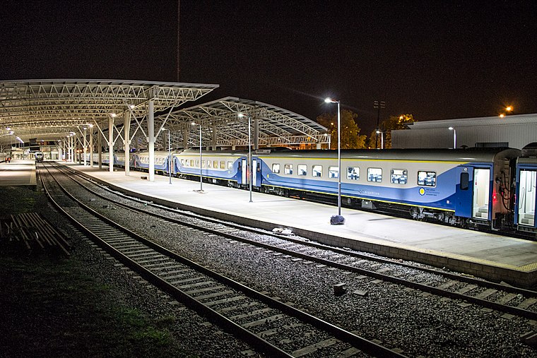
Photo: Wikimedia, CC BY-SA 2.0.
Mar del Plata is a railway and bus terminus in the homonymous city of Buenos Aires Province, Argentina. Opened in 2009 as a bus terminus only, the railway tracks from the old "Norte" station were extended to connect both terminals in 2011 by architect Claudio Luis Lucarelli, adding new platforms to receive trains from Buenos Aires. Mar del Plata railway and bus station is situated 1½ km west of Departamento La Perla 619.
Casino Central
Casino

Photo: Mar del Plata Puntonoticias, CC BY-SA 2.0.
The Casino Central is located in Mar del Plata, Argentina, and is one of the largest casinos in the country. Casino Central is situated 2 km south of Departamento La Perla 619.
Playa Bristol
Beach

Photo: Wikimedia, Public domain.
The Playa Bristol is a beach in Mar del Plata, Argentina, named after the Bristol Hotel. At one time it was highly fashionable, drawing the elite of Buenos Aires for vacations. Playa Bristol is situated 2 km south of Departamento La Perla 619.
Places in the Area
Nearby places include Mar del Plata.
Mar del Plata

Photo: DarwIn, CC BY-SA 3.0.
Mar del Plata is on the southwest coast of the Argentinian sea. It is the second most touristic city in the country after Buenos Aires. You can go to Mar del Plata by plane, by bus, by train or by car.
Departamento La Perla 619
- Type: Residential area
- Address: 619 Avenida Independencia, Mar del Plata
- Location: General Pueyrredón Partido, Buenos Aires, Pampas, Argentina, South America
- View on OpenStreetMap
Latitude
-37.9876° or 37° 59′ 15″ southLongitude
-57.54613° or 57° 32′ 46″ westOpen location code
48J42F63+XGOpenStreetMap ID
node 6893186182OpenStreetMap feature
landuse=residential
This page is based on OpenStreetMap, Wikidata, and Wikimedia Commons.
We’d love your help improving our open data sources. Thank you for contributing.
Satellite Map
Discover Departamento La Perla 619 from above in high-definition satellite imagery.
Notable Places Nearby
Highlights include Plazoleta Ing. Carlos Maria Della Paolera (del Urbanismo) and Plazoleta Alfonsina Storni.
Nearby Places
Explore places such as Raices and Bandera Blanca.
Buenos Aires: Must-Visit Destinations
Delve into Buenos Aires, La Plata, Mar del Plata, and Centro.
Curious Residential Areas to Discover
Uncover intriguing residential areas from every corner of the globe.
About Mapcarta. Data © OpenStreetMap contributors and available under the Open Database License". Text is available under the CC BY-SA 4.0 license, except for photos, directions, and the map. Photo: Mbusin, CC BY-SA 4.0.