18th Street & Guerrero Street
18th Street & Guerrero Street is a transport stop in San Francisco, Bay Area, California. 18th Street & Guerrero Street is situated nearby to the bakery Tartine, as well as near Voice of Christ Church.| Tap on a place to explore it |
Places of Interest Nearby
Highlights include Tartine and Mission San Francisco de Asís.
Tartine
Bakery

Photo: Carl Collins, CC BY 2.0.
Tartine is a small, US-based bakery chain. As of February 2022, it operates three locations in the San Francisco Bay Area, five in Los Angeles, and six in Seoul Capital Area, South Korea.
Mission San Francisco de Asís
Church

Photo: Wikimedia, CC BY-SA 2.0.
The Mission San Francisco de Asís, also known as Mission Dolores, is a historic Catholic church complex in San Francisco, California. Operated by the Archdiocese of San Francisco, the complex was founded in the 18th century by Spanish Catholic missionaries. Mission San Francisco de Asís is situated 1,300 feet northwest of 18th Street & Guerrero Street.
Mission Dolores Park
Park

Photo: Artico2, CC BY-SA 3.0.
Mission Dolores Park, often abbreviated to Dolores Park, is a city park in San Francisco, California. It is located two blocks south of Mission Dolores at the western edge of the Mission District.
Places in the Area
Nearby places include Mission and Duboce Triangle.
Mission
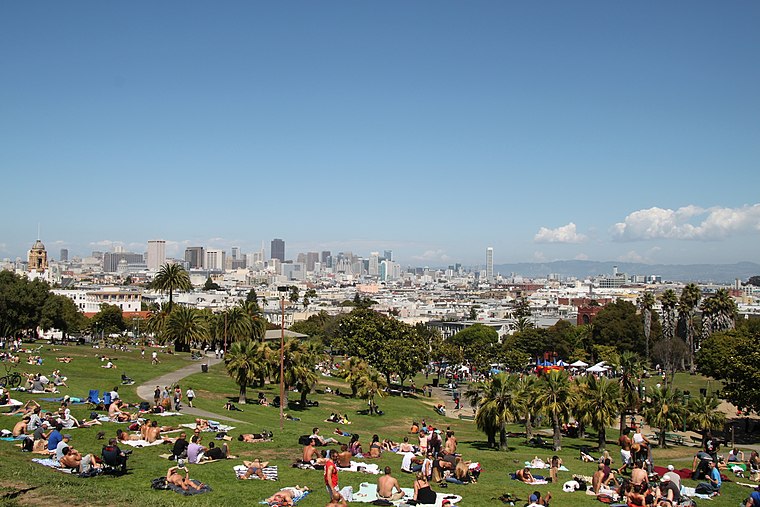
Photo: Tim Bartel, CC BY-SA 2.0.
The Mission District is a district of San Francisco noted for its ethnic diversity, in particular the neighborhood's large Hispanic community. Though the district has gentrified and is among the more expensive areas for real estate in the city, many urban…
Duboce Triangle
Neighborhood

Photo: Wikimedia, Public domain.
The Duboce Triangle is a neighborhood of San Francisco, California, located below Buena Vista Park and between the neighborhoods of the Castro/Eureka Valley, the Mission District, and the Lower Haight.
Castro-Noe Valley

Photo: brian kusler, CC BY 2.0.
The colorful Castro is the famous gay center of San Francisco, a vibrant and historic neighborhood full of businesses geared towards the city's LGBT community.
18th Street & Guerrero Street
- Type: Transport stop
- Category: transportation
- Location: San Francisco, Bay Area, California, United States, North America
- View on OpenStreetMap
Latitude
37.76155° or 37° 45′ 42″ northLongitude
-122.42415° or 122° 25′ 27″ westOperator
San Francisco Municipal RailwayNetwork
MuniOpen location code
849VQH6G+J8OpenStreetMap ID
node 6917261417OpenStreetMap feature
public_transport=stop_position
This page is based on OpenStreetMap, Wikidata, and Wikimedia Commons.
We’d love your help improving our open data sources. Thank you for contributing.
Satellite Map
Discover 18th Street & Guerrero Street from above in high-definition satellite imagery.
Places with the Same Name
Discover other places named “18th Street & Guerrero Street”.
Notable Places Nearby
Highlights include Voice of Christ Church and MURAL 3.
Nearby Places
Explore places such as 18th Street & Guerrero Street and Fayes Coffee.
San Francisco: Must-Visit Destinations
Delve into Golden Gate, Chinatown-North Beach, Civic Center-Tenderloin, and Fisherman’s Wharf.
Curious Transport Stops to Discover
Uncover intriguing transport stops from every corner of the globe.
About Mapcarta. Data © OpenStreetMap contributors and available under the Open Database License". Text is available under the CC BY-SA 4.0 license, except for photos, directions, and the map. Photo: Wikimedia, CC BY-SA 3.0.