Alfred Water District
Alfred Water District is a government office in Town of Alfred, York County, Maine which is located on Waterboro Road. Alfred Water District is situated nearby to North Alfred Baptist Church, as well as near Alfred Town Hall.| Tap on a place to explore it |
Places of Interest Nearby
Highlights include Alfred Historic District.
Alfred Historic District
Protected area

Photo: Magicpiano, CC BY-SA 3.0.
The Alfred Historic District is an historic district encompassing the historic village center of Alfred, Maine. The roughly Y-shaped district radiates from the junction of Oak Street with Kennebunk, Waterboro, and Saco Roads, and is characterized by high-quality 19th-century wood-frame buildings.
Places in the Area
Nearby places include Alfred and Waterboro.
Alfred

Photo: Zcarstvnz, CC BY-SA 4.0.
Alfred is a town in York County, Maine, United States. As of the 2020 census, the town population was 3,073. Alfred is the seat of York County, and home to part of the Massabesic Experimental Forest.
Waterboro

Photo: Wikimedia, Public domain.
Waterboro is a town in York County, Maine, United States. The population was 7,936 at the 2020 census. It is part of the Portland-South Portland-Biddeford metropolitan area.
Sanford
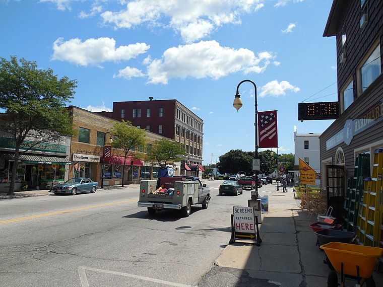
Photo: Faolin42, CC BY-SA 4.0.
Sanford is a city in York County, Maine, United States. The population was 21,982 in the 2020 census, making it the seventh largest municipality in the state.
Alfred Water District
- Type: Government office
- Address: 32 Waterboro Road, Alfred, ME 04002
- Categories: office and government building
- Location: Town of Alfred, York County, Maine, New England, United States, North America
- View on OpenStreetMap
Latitude
43.47935° or 43° 28′ 46″ northLongitude
-70.71749° or 70° 43′ 3″ westOpen location code
87MFF7HM+P2OpenStreetMap ID
node 6984659617OpenStreetMap feature
office=government
This page is based on OpenStreetMap, Wikidata, and Wikimedia Commons.
We’d love your help improving our open data sources. Thank you for contributing.
Satellite Map
Discover Alfred Water District from above in high-definition satellite imagery.
Notable Places Nearby
Highlights include North Alfred Baptist Church and Alfred Town Hall.
Nearby Places
Explore places such as Folsoms Upholstery Shop and Alfred Country Store.
Maine: Must-Visit Destinations
Delve into Augusta, Portland, Bangor, and Acadia National Park.
Curious Government Offices to Discover
Uncover intriguing government offices from every corner of the globe.
About Mapcarta. Data © OpenStreetMap contributors and available under the Open Database License". Text is available under the CC BY-SA 4.0 license, except for photos, directions, and the map. Photo: gary-brownell, CC BY-SA 2.0.