Rastplatz An den Weingärten
Rastplatz An den Weingärten is a picnic site in Bad Vöslau, Politischer Bezirk Baden, Lower Austria. Rastplatz An den Weingärten is situated nearby to Beethoven Denkmal, as well as near the grassland Hüterriegel.| Tap on a place to explore it |
Places of Interest Nearby
Highlights include Jubiläumswarte and Fire station Gainfarn.
Jubiläumswarte
Scenic viewpoint

Photo: Bwag, CC BY-SA 3.0.
Jubiläumswarte is a scenic viewpoint, which is situated 1½ km northeast of Rastplatz An den Weingärten.
Fire station Gainfarn
Fire station

Photo: Karl Gruber, CC BY-SA 4.0.
Fire station Gainfarn is situated 1¼ km east of Rastplatz An den Weingärten.
Kloster der Dienerinnen des Heiligsten Herzens Jesu
Heritage site

Photo: PLauppert, CC BY-SA 3.0.
Kloster der Dienerinnen des Heiligsten Herzens Jesu is a heritage site, which is situated 1¼ km east of Rastplatz An den Weingärten.
Places in the Area
Nearby places include Bad Vöslau and Sooß.
Bad Vöslau
Town

Photo: Wolfgang glock, CC BY 3.0.
Bad Vöslau is a spa town and municipality in the state of Lower Austria. It is also known as the cradle of the Austrian red wine cultivation. The population, as of 2022, is 12,424. Bad Vöslau is situated 2½ km east of Rastplatz An den Weingärten.
Sooß
Village
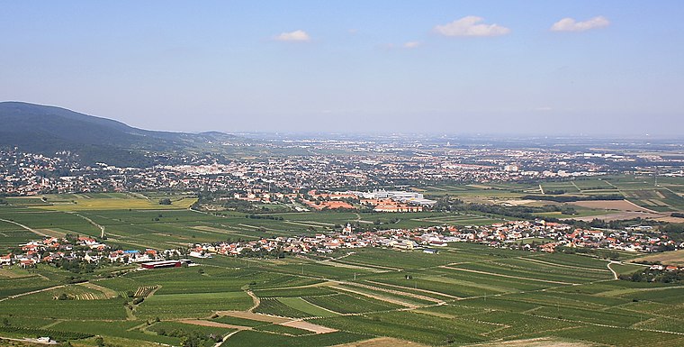
Photo: Bwag, CC BY-SA 3.0.
Sooß is a town in the district of Baden in Lower Austria, Austria. Sooß is situated 3½ km northeast of Rastplatz An den Weingärten.
St. Veit an der Triesting
Village

Photo: Herzi Pinki, CC BY-SA 4.0.
St. Veit an der Triesting is a village, which is situated 3½ km southwest of Rastplatz An den Weingärten.
Rastplatz An den Weingärten
- Type: Picnic site
- Category: tourism
- Location: Bad Vöslau, Politischer Bezirk Baden, Lower Austria, Austria, Central Europe, Europe
- View on OpenStreetMap
Latitude
47.96507° or 47° 57′ 54″ northLongitude
16.18027° or 16° 10′ 49″ eastOpen location code
8FVRX58J+24OpenStreetMap ID
node 698824186OpenStreetMap feature
tourism=picnic_site
This page is based on OpenStreetMap, Wikidata, and Wikimedia Commons.
We’d love your help improving our open data sources. Thank you for contributing.
Satellite Map
Discover Rastplatz An den Weingärten from above in high-definition satellite imagery.
Notable Places Nearby
Highlights include Beethoven Denkmal and Hüterriegel.
Nearby Places
Explore places such as Mariendenkmal and Rastplatz An den Kuhschellen.
Lower Austria: Must-Visit Destinations
Delve into St. Pölten, Wiener Neustadt, Amstetten, and Klosterneuburg.
Curious Picnic Sites to Discover
Uncover intriguing picnic sites from every corner of the globe.
About Mapcarta. Data © OpenStreetMap contributors and available under the Open Database License". Text is available under the CC BY-SA 4.0 license, except for photos, directions, and the map. Photo: Lonezor, CC BY-SA 3.0.