East Lansing
East Lansing is a railway stop in City of East Lansing, Ingham, Michigan. East Lansing is situated nearby to the railway station Capital Area Multimodal Gateway, as well as near University United Methodist Church.| Tap on a place to explore it |
Places of Interest Nearby
Highlights include Capital Area Multimodal Gateway and T. B. Simon Power Plant.
Capital Area Multimodal Gateway
Railway station

Photo: Shadowlink1014, Public domain.
Capital Area Multimodal Gateway, also known as East Lansing station, is an intermodal transit station in East Lansing, Michigan. Operated by the Capital Area Transportation Authority, it is served by Amtrak's Blue Water passenger train, local buses, and intercity buses. Capital Area Multimodal Gateway is situated 480 feet west of East Lansing.
T. B. Simon Power Plant
Power station

Photo: Michael P. McDowell, CC BY-SA 3.0.
The T.B. Simon Power Plant is a multi-fuel cogeneration facility located on the campus of Michigan State University in East Lansing, Michigan, United States. T. B. Simon Power Plant is situated 2,600 feet east of East Lansing.
Breslin Student Events Center
Stadium
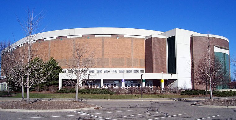
Photo: Lovelac7, CC BY-SA 3.0.
The Jack Breslin Student Events Center is a multi-purpose arena at Michigan State University in East Lansing, Michigan. The arena opened in 1989, and is named for Jack Breslin, MSU alumnus, former athlete and administrator, who first began pushing for the arena in 1969. Breslin Student Events Center is situated 3,300 feet north of East Lansing.
Places in the Area
Nearby places include East Lansing and REO Town.
East Lansing
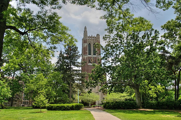
Photo: Jeffness, CC BY-SA 2.5.
East Lansing is a city in the U.S. state of Michigan. Most of the city lies within Ingham County, although a small portion extends north into Clinton County.
REO Town
Neighborhood

Photo: Dj1997, CC BY-SA 3.0.
REO Town is a district in Lansing, Michigan, United States, located south of downtown. The neighborhood is bordered by West Malcolm X Street to the north; South Cedar Street BL I-96 to the east; West Mount Hope Avenue to the south; and Townsend Street, the Grand River, and South Martin Luther King Jr. REO Town is situated 3 miles west of East Lansing.
Lansing

Photo: Brett Marr, CC BY-SA 3.0.
Lansing is a pleasant city, and as Michigan's state capital, it is home to many government offices. Downtown Lansing has a historic shopping district amidst the campus of Thomas M. Cooley Law School.
East Lansing
- Type: Railway stop
- Categories: transport stop and transportation
- Location: City of East Lansing, Ingham, Michigan, Midwest, United States, North America
- View on OpenStreetMap
Latitude
42.7192° or 42° 43′ 9″ northLongitude
-84.49415° or 84° 29′ 39″ westNetwork
AmtrakOpen location code
86JQPG94+M8OpenStreetMap ID
node 7024286696OpenStreetMap feature
public_transport=stop_positionOpenStreetMap feature
railway=stop
This page is based on OpenStreetMap, Wikidata, and Wikimedia Commons.
We’d love your help improving our open data sources. Thank you for contributing.
Satellite Map
Discover East Lansing from above in high-definition satellite imagery.
Places with the Same Name
Discover other places named “East Lansing”.
Notable Places Nearby
Highlights include Capital Area Multimodal Gateway and East Lansing Hot Yoga.
Nearby Places
Explore places such as Better Asian Mart and Marathon.
Michigan: Must-Visit Destinations
Delve into Detroit, Ann Arbor, Lansing, and Grand Rapids.
Curious Railway Stops to Discover
Uncover intriguing railway stops from every corner of the globe.
About Mapcarta. Data © OpenStreetMap contributors and available under the Open Database License". Text is available under the CC BY-SA 4.0 license, except for photos, directions, and the map. Photo: Wikimedia, CC0.