Clínica Eugenio Sue
Clínica Eugenio Sue is a clinic in Mexico State, Central Mexico. Clínica Eugenio Sue is situated nearby to the post office DHL, as well as near Hospitalito.| Tap on a place to explore it |
Places of Interest Nearby
Highlights include Embassy of India and National Museum of Anthropology.
Embassy of India
Government office

Photo: Aquintero82, CC BY-SA 4.0.
India and Mexico have had contact since the 1500s, but formal diplomatic relations were first established in 1950. Both nations are members of the G-20 major economies and the United Nations. Embassy of India is situated 290 metres southwest of Clínica Eugenio Sue.
National Museum of Anthropology
Museum
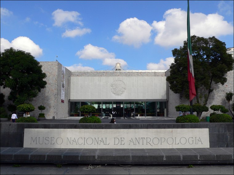
Photo: Wikimedia, CC BY-SA 3.0.
The National Museum of Anthropology is a national museum of Mexico. It is the largest and most visited museum in Mexico. Located in the area between Paseo de la Reforma and Mahatma Gandhi Street within Chapultepec Park in Mexico City, the museum contains… National Museum of Anthropology is situated 1½ km southeast of Clínica Eugenio Sue.
Embassy of Ecuador
Government office

Photo: Aquintero82, CC BY-SA 4.0.
Embassy of Ecuador is a government office, which is situated 370 metres south of Clínica Eugenio Sue.
Places in the Area
Nearby places include Polanco and Nuevo Polanco.
Polanco

Photo: Matthew Rutledge, CC BY 2.0.
Polanco refers to an area of Mexico City north of Chapultepec Park. This district is delimited by Paseo de la Reforma to the south, Boulevard Manuel Avila Camacho to the west, Avenida Ejercito Nacional to the north and Avenida Mariano Escobedo to the east.
Nuevo Polanco
Quarter

Photo: Wikimedia, CC BY-SA 3.0.
Nuevo Polanco is an area of Mexico City formerly consisting of warehouses and factories, bordering the upscale Polanco on the north across Avenida Ejército Nacional.
Tlacopan
Neighborhood

Photo: Wikimedia, Public domain.
Tlacopan, also called Tacuba, was a Tepanec / Mexica altepetl on the western shore of Lake Texcoco. The site is today the neighborhood of Tacuba, in Mexico City.
Clínica Eugenio Sue
- Type: Clinic
- Category: health care
- Location: Mexico State, Central Mexico, Mexico, North America
- View on OpenStreetMap
Latitude
19.43773° or 19° 26′ 16″ northLongitude
-99.19359° or 99° 11′ 37″ westOpen location code
76F2CRQ4+3HOpenStreetMap ID
node 7134282487OpenStreetMap feature
amenity=clinicOpenStreetMap feature
healthcare=clinic
This page is based on OpenStreetMap, Wikidata, and Wikimedia Commons.
We’d love your help improving our open data sources. Thank you for contributing.
Satellite Map
Discover Clínica Eugenio Sue from above in high-definition satellite imagery.
Notable Places Nearby
Highlights include DHL and Hospitalito.
Nearby Places
Explore places such as Café Genova and Peinados Chata.
Mexico State: Must-Visit Destinations
Delve into Tequixquiac, Toluca, Teotihuacan, and Ecatepec.
Curious Clinics to Discover
Uncover intriguing clinics from every corner of the globe.
About Mapcarta. Data © OpenStreetMap contributors and available under the Open Database License". Text is available under the CC BY-SA 4.0 license, except for photos, directions, and the map. Photo: Wikimedia, CC0.