Santuario dell’Angelo
Santuario dell’Angelo is in Piovene Rocchette, Vicenza, Veneto. Santuario dell’Angelo is situated nearby to the church Santuario Madonna dell’Angelo, as well as near the ruins Castel Manduca.| Tap on a place to explore it |
Places of Interest Nearby
Highlights include Monte Summano and Parco e Villa Rossi.
Monte Summano
Peak

Photo: Twice25, CC BY-SA 3.0.
Monte Summano is a mountain in the Veneto region, Italy. It has an elevation of 1,296 metres.
Parco e Villa Rossi
Museum

Photo: Recfs, CC BY-SA 4.0.
Parco e Villa Rossi is a museum, which is situated 3 km southwest of Santuario dell’Angelo.
Saint Christopher church
Church

Photo: Marchetto da Trieste, CC BY-SA 4.0.
Saint Christopher church is situated 3½ km north of Santuario dell’Angelo.
Places in the Area
Nearby places include Tretto and Schio.
Tretto
Suburb
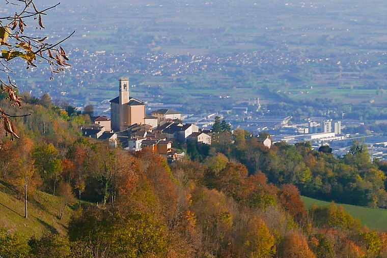
Photo: Claudio Gioseffi, CC BY-SA 4.0.
Tretto is a suburb, which is situated 6 km west of Santuario dell’Angelo.
Schio
Town

Photo: Spadedrabbit, CC BY-SA 3.0.
Schio is a town and comune in the province of Vicenza situated north of Vicenza and east of the Lake Garda. It is surrounded by the Little Dolomites and Mount Pasubio. Schio is situated 7 km southwest of Santuario dell’Angelo.
Thiene
Town

Photo: Verdissimo123, CC BY-SA 4.0.
Thiene is a city and comune in the province of Vicenza, in northern Italy, located approximately 75 kilometres west of Venice and 200 kilometres east of Milan. Thiene is situated 8 km southeast of Santuario dell’Angelo.
Santuario dell’Angelo
- Type: Sign
- Categories: information and tourism
- Location: Piovene Rocchette, Vicenza, Veneto, Northeast Italy, Italy, Europe
- View on OpenStreetMap
Latitude
45.75836° or 45° 45′ 30″ northLongitude
11.41828° or 11° 25′ 6″ eastElevation
533 metres (1,749 feet)Open location code
8FQHQC59+88OpenStreetMap ID
node 7141252242OpenStreetMap feature
tourism=information
This page is based on OpenStreetMap, Wikidata, and Wikimedia Commons.
We’d love your help improving our open data sources. Thank you for contributing.
Satellite Map
Discover Santuario dell’Angelo from above in high-definition satellite imagery.
Notable Places Nearby
Highlights include Santuario Madonna dell’Angelo and Castel Manduca.
Nearby Places
Explore places such as Trattoria All’Angelo and Spiadi.
Curious Places to Discover
Uncover intriguing places from every corner of the globe.
About Mapcarta. Data © OpenStreetMap contributors and available under the Open Database License". Text is available under the CC BY-SA 4.0 license, except for photos, directions, and the map. Photo: Wikimedia, CC0.