Maximum Nutrition UK
Maximum Nutrition UK is a convenience store in Luton, England which is located on Old Bedford Road. Maximum Nutrition UK is situated nearby to St Ninian’s United Reformed Church, as well as near Hope Church Open House Lounge.| Tap on a place to explore it |
Places of Interest Nearby
Highlights include Luton railway station and Kenilworth Road.
Luton railway station
Railway station
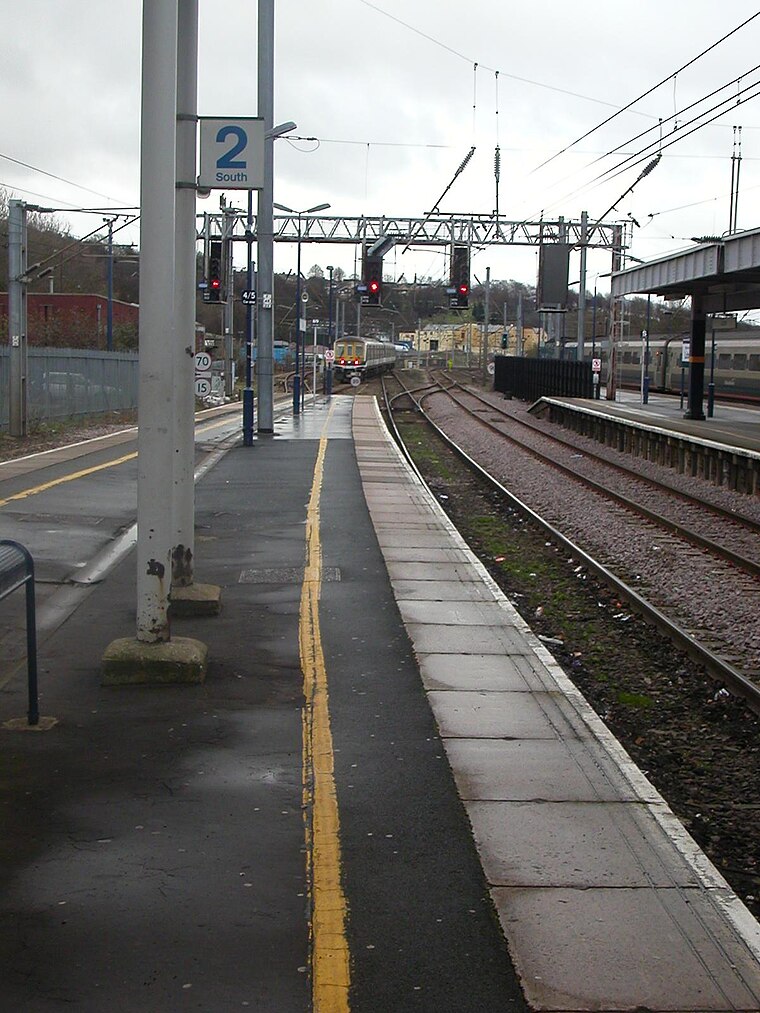
Photo: Hassocks5489, Public domain.
Luton railway station is located in the town centre of Luton, Bedfordshire, England. The station is about three minutes' walk from Luton Point Shopping Centre. It is situated on the Midland Main Line and is operated by Thameslink. Luton railway station is situated 840 feet southeast of Maximum Nutrition UK.
Kenilworth Road
Stadium
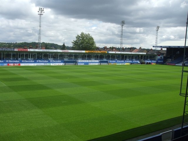
Photo: Barry Ephgrave, CC BY-SA 2.0.
Kenilworth Road, known affectionately as The Kenny, is a football stadium in the area of Bury Park, Luton, Bedfordshire, England. It has been the home ground of Luton Town Football Club since 1905. Kenilworth Road is situated 3,300 feet west of Maximum Nutrition UK.
Luton Town Hall
Town hall

Photo: Alex Liivet, CC0.
Luton Town Hall is a building at the junction between Manchester Street, Upper George Street and George Street, Luton, England; the current building was completed in 1936 on the site of the older Town Hall, which was burnt down on 19 July 1919, following the Peace Day Riots. Luton Town Hall is situated 1,500 feet south of Maximum Nutrition UK.
Places in the Area
Nearby places include High Town and Round Green.
High Town
Suburb

Photo: Wikimedia, CC BY-SA 4.0.
High Town is an inner area of Luton immediately north of Luton railway station, and a ward of the Borough of Luton, in the ceremonial county of Bedfordshire, England.
Round Green
Suburb

Photo: Nigel Cox, CC BY-SA 2.0.
Round Green is a suburb of Luton just over 1 mile north-east of the town centre, and a ward of the Borough of Luton, in the ceremonial county of Bedfordshire, England.
Stopsley
Suburb

Photo: StuJB, CC BY-SA 3.0.
Stopsley is a suburb in the north-east of Luton, Bedfordshire, England. The area is roughly bounded by the edge of Luton to the north, Vauxhall Way and Turners Road North to the south, Bradgers Hill to the west, and Cannon Lane, Stapleford Road and Brays Road to the east.
Maximum Nutrition UK
- Type: Convenience store
- Address: 26 Old Bedford Road, Luton, LU2 7NZ
- Categories: shop and food
- Location: Luton, England, United Kingdom, Britain and Ireland, Europe
- View on OpenStreetMap
Latitude
51.88388° or 51° 53′ 2″ northLongitude
-0.4171° or 0° 25′ 2″ westOpen location code
9C3XVHMM+H5OpenStreetMap ID
node 7195644299OpenStreetMap feature
shop=convenience
This page is based on OpenStreetMap, Wikidata, and Wikimedia Commons.
We’d love your help improving our open data sources. Thank you for contributing.
Satellite Map
Discover Maximum Nutrition UK from above in high-definition satellite imagery.
Notable Places Nearby
Highlights include St Ninian’s United Reformed Church and Hope Church Open House Lounge.
Nearby Places
Explore places such as Celmic and Lemon Crispy Chicken and Pizza.
England: Must-Visit Destinations
Delve into London, Manchester, Sheffield, and Leeds.
Curious Convenience Stores to Discover
Uncover intriguing convenience stores from every corner of the globe.
About Mapcarta. Data © OpenStreetMap contributors and available under the Open Database License". Text is available under the CC BY-SA 4.0 license, except for photos, directions, and the map. Photo: Bodrogikg, CC BY-SA 4.0.