Busky Hill
Busky Hill is a peak in Carleton, Craven District, England. Busky Hill is situated nearby to the village Carleton-in-Craven, as well as near Broughton.| Tap on a place to explore it |
Places of Interest
Highlights include Skipton railway station and All Saints’ Church, Broughton.
Skipton railway station
Railway station
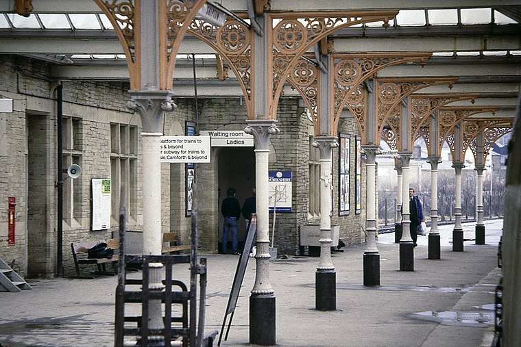
Photo: Steven Duhig, CC BY-SA 2.0.
Skipton railway station is a Grade II listed station which serves the market town of Skipton in North Yorkshire, England. It is a stop on the Airedale Line, which provides access to destinations such as Leeds, Bradford, Carlisle, Lancaster and Morecambe.
All Saints’ Church, Broughton
Church

Photo: Alexander P Kapp, CC BY-SA 2.0.
All Saints' Church is the parish church of Broughton, a village in North Yorkshire, in England. No church in Broughton is recorded in the Domesday Book, the first reference to one being in 1120.
Places in the Area
Nearby places include Skipton and Carleton-in-Craven.
Skipton
 Skipton is a market town in North Yorkshire, with a population of 15,000 in 2021. It has a sturdy castle and scenic canal; it's within a short travel time of the Leeds-Bradford conurbation and is on the southern edge of the Yorkshire Dales, so it's a popular day-trip destination.
Carleton-in-Craven
Village

Photo: Wikimedia, CC BY-SA 2.0.
Carleton-in-Craven is a small village and civil parish in the county of North Yorkshire, England, and situated just over 1.5 miles south-west from the market town of Skipton.
Bradley, North Yorkshire
Locality

Photo: Wikimedia, CC BY-SA 2.0.
Bradley is a village in North Yorkshire, England. It is situated between Skipton and Keighley, approximately 1⁄2 mile from the A629 and 2 miles from the nearby town of Skipton.
Busky Hill
- Type: Peak
- Category: landform
- Location: Carleton, Craven District, North Yorkshire, Yorkshire, England, United Kingdom, Britain and Ireland, Europe
- View on OpenStreetMap
Latitude
53.9473° or 53° 56′ 50″ northLongitude
-2.0669° or 2° 4′ 1″ westOpen location code
9C5VWWWM+W6OpenStreetMap ID
node 721002286OpenStreetMap feature
natural=peak
This page is based on OpenStreetMap, Wikidata, and Wikimedia Commons.
We’d love your help improving our open data sources. Thank you for contributing.
Satellite Map
Discover Busky Hill from above in high-definition satellite imagery.
Localities in the Area
Explore places such as Broughton and Thorlby.
Notable Places Nearby
Highlights include Greenber Hill and Banner Hill.
North Yorkshire: Must-Visit Destinations
Delve into York, Middlesbrough, Harrogate, and Ripon.
Curious Peaks to Discover
Uncover intriguing peaks from every corner of the globe.
About Mapcarta. Data © OpenStreetMap contributors and available under the Open Database License". Text is available under the CC BY-SA 4.0 license, except for photos, directions, and the map. Photo: Michael Bryan, CC BY 2.0.