Bátonyterenyei reptér
Bátonyterenyei reptér is an aerodrome in Nógrád County, Northern Hungary. Bátonyterenyei reptér is situated nearby to the suburb Újlak, as well as near Kisterenye.| Tap on a place to explore it |
Places of Interest
Highlights include Kisterenye railway station and Szent István vértanú-templom.

Szent István vértanú-templom
Church
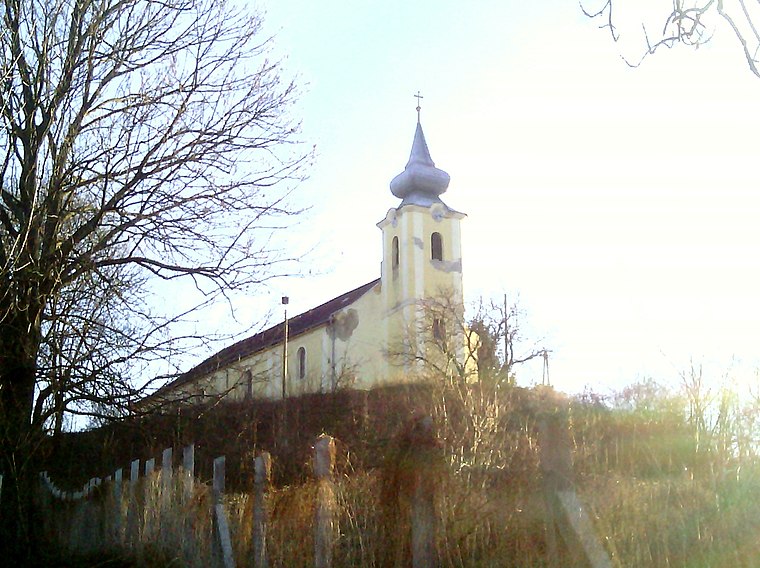
Photo: Rakás, CC BY-SA 4.0.
Szent István vértanú-templom is a church.

Places in the Area
Nearby places include Bátonyterenye and Kisterenye.
Bátonyterenye

Photo: Wikimedia, CC BY-SA 2.5.
Bátonyterenye is a town in Nógrád County, Hungary, under the Mátra mountain range, beside the Zagyva river. As of 2022 census, it has a population of 11,296.

Bátonyterenyei reptér
- Type: Aerodrome
- Category: transportation
- Location: Nógrád County, Northern Hungary, Hungary, Central Europe, Europe
- View on OpenStreetMap
Latitude
48.0253° or 48° 1′ 31″ northLongitude
19.805° or 19° 48′ 18″ eastOperator
Cserhát RepülőklubOpen location code
8FWX2RG4+42OpenStreetMap ID
node 7220731435OpenStreetMap feature
aeroway=aerodrome
This page is based on OpenStreetMap, Wikidata, and Wikimedia Commons.
We’d love your help improving our open data sources. Thank you for contributing.
Satellite Map
Discover Bátonyterenyei reptér from above in high-definition satellite imagery.
Localities in the Area
Explore places such as Újlak and Szúpatak.
Notable Places Nearby
Highlights include Fúró-kút and Kisterenyei futballpálya.
Nógrád County: Must-Visit Destinations
Delve into Salgótarján, Hollókő, Balassagyarmat, and Szécsény.
Curious Aerodromes to Discover
Uncover intriguing aerodromes from every corner of the globe.
About Mapcarta. Data © OpenStreetMap contributors and available under the Open Database License". Text is available under the CC BY-SA 4.0 license, except for photos, directions, and the map. Photo: Pe-Jo, CC BY-SA 3.0.