Chemin Reid (doré, brochet, perchaude)
Chemin Reid (doré, brochet, perchaude) is a fishing area in Quebec, Canada. Chemin Reid (doré, brochet, perchaude) is situated nearby to the islet Îles Marchesseault, as well as near the park Parc St-Jean.| Tap on a place to explore it |
Places of Interest Nearby
Highlights include Shawinigan station and Caserne Champlain.
Shawinigan station
Railway station

Photo: Fralambert, CC BY-SA 3.0.
Shawinigan station is located on Chemin du CN in Shawinigan, Quebec, Canada. It is a former CN Rail station and is currently used by Via Rail for two routes running from Montreal. Shawinigan station is situated 2 km southwest of Chemin Reid (doré, brochet, perchaude).
Caserne Champlain
Fire station

Photo: Fralambert, CC BY-SA 4.0.
Caserne Champlain is a fire station, which is situated 1½ km west of Chemin Reid (doré, brochet, perchaude).
Église Assomption (Shawinigan)
Church

Photo: Asclepias, CC BY-SA 3.0.
Église Assomption (Shawinigan) is a church, which is situated 1¼ km northwest of Chemin Reid (doré, brochet, perchaude).
Places in the Area
Nearby places include Shawinigan and Shawinigan-Sud.
Shawinigan

Photo: Wikimedia, Public domain.
Shawinigan is a city of 50,000 people in the Mauricie region of Quebec. It arose because of its tremendous hydro-electric generation capacity, and is now focusing on tourism.
Shawinigan-Sud
Suburb

Photo: Vintotal, CC BY-SA 3.0.
Shawinigan-Sud is a predominantly French-speaking settlement in the Mauricie area in Quebec, Canada, on the Saint-Maurice River. In 1996, its population was 11,804. Shawinigan-Sud is situated 5 km southwest of Chemin Reid (doré, brochet, perchaude).
Grand-Mère
Suburb
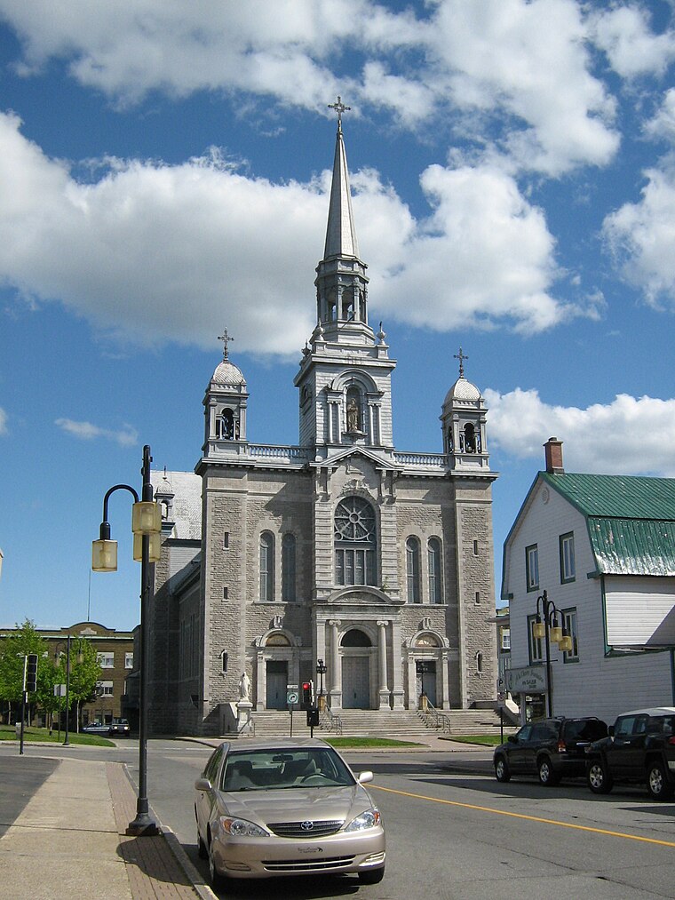
Photo: Fralambert, CC BY-SA 3.0.
Grand-Mère is a settlement and former municipality in central Quebec, Canada on the Saint-Maurice River. As a result of the municipal reorganization in Quebec which took effect at the beginning of 2002, Grand-Mère now forms part of the City of Shawinigan. Grand-Mère is situated 6 km north of Chemin Reid (doré, brochet, perchaude).
Chemin Reid (doré, brochet, perchaude)
- Type: Fishing area
- Categories: recreation area and sports location
- Location: Quebec, Canada, North America
- View on OpenStreetMap
Latitude
46.55942° or 46° 33′ 34″ northLongitude
-72.72326° or 72° 43′ 24″ westOpen location code
87R9H75G+QMOpenStreetMap ID
node 7231149091OpenStreetMap feature
leisure=fishing
This page is based on OpenStreetMap, Wikidata, and Wikimedia Commons.
We’d love your help improving our open data sources. Thank you for contributing.
Satellite Map
Discover Chemin Reid (doré, brochet, perchaude) from above in high-definition satellite imagery.
Notable Places Nearby
Highlights include Îles Marchesseault and Parc St-Jean.
Nearby Places
Explore places such as Gélinite inc. and Poste Thibaudeau.
Quebec: Must-Visit Destinations
Delve into Montreal, Gaspé, Quebec City, and Percé.
Curious Fishing Areas to Discover
Uncover intriguing fishing areas from every corner of the globe.
About Mapcarta. Data © OpenStreetMap contributors and available under the Open Database License". Text is available under the CC BY-SA 4.0 license, except for photos, directions, and the map. Photo: Taxiarchos228, CC BY-SA 3.0.