Feldlage
Feldlage is a neighborhood in Karlsruhe, Rhine-Neckar, Baden-Württemberg. Feldlage is situated nearby to the locality Kleinseeäcker, as well as near Kleinoberfeld.| Tap on a place to explore it |
Places of Interest
Highlights include Karlsruhe-Oberreut Badeniaplatz and St. Cyriakus.


Europahalle
Stadium
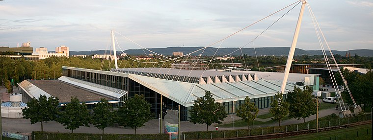
Photo: Bough, CC BY-SA 2.0 de.
Europahalle is an indoor sporting arena located in Karlsruhe, Germany. The capacity of the arena is 9,000 people. The venue has featured a number of world record performances in athletics, including a jump of 2.07 m in the high jump by Heike Henkel in 1992, when the Europahalle hosted the German Indoor Championships.
Places in the Area
Nearby places include Mühlburg and Rheinstetten.
Mühlburg
Suburb

Photo: Baden-Paul, CC0.
Mühlburg is a district of Karlsruhe, Germany. The district is further divided into Alt-Mühlburg, Weingärtensiedlung, Rheinhafen and Mühlburger Feld. Mühlburg is situated 3½ km north of Feldlage.
Rheinstetten
Town

Photo: DALIBRI, CC BY-SA 4.0.
Rheinstetten is a town in the west of Baden-Württemberg on the border to Rhineland-Palatinate. It is situated to the south-west of Karlsruhe and belongs to the rural district of Karlsruhe. Rheinstetten is situated 4½ km west of Feldlage.
Ettlingen

Photo: Martin-D, CC BY-SA 2.5.
Ettlingen, tucked between Karlsruhe and the Black Forest, is a small city with a history dating back to the Roman Empire.
Feldlage
- Type: Neighborhood
- Category: locality
- Location: Karlsruhe, Karlsruhe Region, Rhine-Neckar, Baden-Württemberg, Germany, Central Europe, Europe
- View on OpenStreetMap
Latitude
48.98268° or 48° 58′ 58″ northLongitude
8.36709° or 8° 22′ 2″ eastOpen location code
8FWCX9M8+3ROpenStreetMap ID
node 7259253893OpenStreetMap feature
place=neighbourhood
This page is based on OpenStreetMap, Wikidata, and Wikimedia Commons.
We’d love your help improving our open data sources. Thank you for contributing.
Satellite Map
Discover Feldlage from above in high-definition satellite imagery.
Localities in the Area
Explore places such as Kleinseeäcker and Kleinoberfeld.
Notable Places Nearby
Highlights include Badeniaplatz and Spiel- und Sportanlage Badeniaplatz.
Rhine-Neckar: Must-Visit Destinations
Delve into Heidelberg, Mannheim, Heilbronn, and Sinsheim.
Curious Neighborhoods to Discover
Uncover intriguing neighborhoods from every corner of the globe.
About Mapcarta. Data © OpenStreetMap contributors and available under the Open Database License". Text is available under the CC BY-SA 4.0 license, except for photos, directions, and the map. Photo: Ruhrfisch, CC BY-SA 3.0.