Beim abgeschlagenen Kreuz
Beim abgeschlagenen Kreuz is a locality in Lower Austria, Austria. Beim abgeschlagenen Kreuz is situated nearby to the locality Todtenmannbreiten, as well as near Ramhartl.| Tap on a place to explore it |
Places of Interest
Highlights include Blauer Berg and Friedhof Stronsdorf.
Blauer Berg
Peak

Photo: Stefan.lefnaer, CC BY-SA 3.0 at.
Blauer Berg is a peak, which is situated 3 km northeast of Beim abgeschlagenen Kreuz.
Friedhof Stronsdorf
Cemetery

Photo: Haeferl, CC BY-SA 4.0.
Friedhof Stronsdorf is a cemetery, which is situated 3½ km northwest of Beim abgeschlagenen Kreuz.
Ortskapelle Unterschoderlee
Church
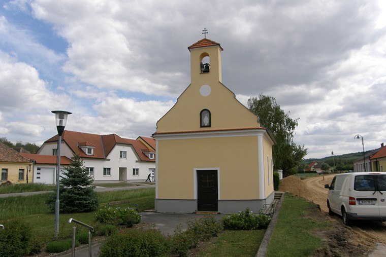
Photo: JonnyBrazil, CC BY-SA 3.0 at.
Ortskapelle Unterschoderlee is a church, which is situated 4 km north of Beim abgeschlagenen Kreuz.
Places in the Area
Nearby places include Kleinkadolz.
Kleinkadolz
Village
 Kleinkadolz is a village, which is situated 7 km southwest of Beim abgeschlagenen Kreuz.
Beim abgeschlagenen Kreuz
- Type: Locality
- Location: Lower Austria, Austria, Central Europe, Europe
- View on OpenStreetMap
Latitude
48.62013° or 48° 37′ 13″ northLongitude
16.3281° or 16° 19′ 41″ eastOpen location code
8FWRJ8CH+36OpenStreetMap ID
node 7344187218OpenStreetMap feature
place=locality
This page is based on OpenStreetMap, Wikidata, and Wikimedia Commons.
We’d love your help improving our open data sources. Thank you for contributing.
Satellite Map
Discover Beim abgeschlagenen Kreuz from above in high-definition satellite imagery.
Localities in the Area
Explore places such as Todtenmannbreiten and Ramhartl.
Notable Places Nearby
Highlights include Unsere Liebe Frau and Bildeiche.
Lower Austria: Must-Visit Destinations
Delve into St. Pölten, Wiener Neustadt, Amstetten, and Klosterneuburg.
Curious Localities to Discover
Uncover intriguing localities from every corner of the globe.
About Mapcarta. Data © OpenStreetMap contributors and available under the Open Database License". Text is available under the CC BY-SA 4.0 license, except for photos, directions, and the map. Photo: Lonezor, CC BY-SA 3.0.