Alfonso Valerio
Alfonso Valerio is a monument in Trieste, Friuli-Venezia Giulia. Alfonso Valerio is situated nearby to the forest Monte Fiascone, as well as near the university Centro Interdipartimentale di Microscopia Avanzata ‘Carlo e Dirce Callerio’ - CIMA.| Tap on a place to explore it |
Places of Interest Nearby
Highlights include Civico Orto Botanico di Trieste and San Giovanni Decollato Church.
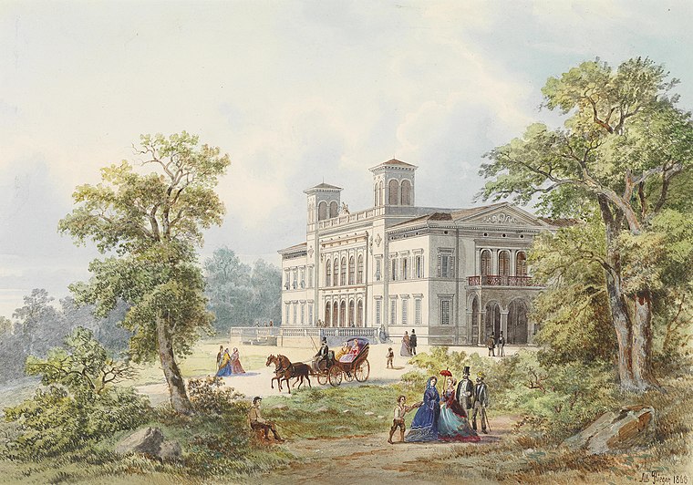
Civico Orto Botanico di Trieste
Garden

Photo: Tiesse, Public domain.
The Civico Orto Botanico di Trieste.
San Giovanni Decollato Church
Church

Photo: Tiesse, Public domain.
San Giovanni Decollato Church is situated 1 km southeast of Alfonso Valerio.
Politeama Rossetti
Theater building

Photo: Triestino, Public domain.
Politeama Rossetti is a theatre in the Italian city of Trieste. With over 60 shows scheduled each season, running from October to June, its stage shows include plays, musicals, ballet, dance and rock concerts. Politeama Rossetti is situated 1½ km southwest of Alfonso Valerio.
Places in the Area
Nearby places include Chiadino and Sottomonte.

Opicina
Town
Opicina, formerly Poggioreale del Carso in Italian, is a town in northeastern Italy, close to the Slovenian border at Fernetti. Opicina is a frazione of the comune of Trieste, the provincial and regional capital. Opicina is situated 3 km north of Alfonso Valerio.
Alfonso Valerio
- Type: Monument
- Category: historic site
- Location: Trieste, Province of Trieste, Friuli-Venezia Giulia, Northeast Italy, Italy, Europe
- View on OpenStreetMap
Latitude
45.6627° or 45° 39′ 46″ northLongitude
13.79775° or 13° 47′ 52″ eastOpen location code
8FQMMQ7X+33OpenStreetMap ID
node 7346612672OpenStreetMap feature
historic=monument
This page is based on OpenStreetMap, Wikidata, and Wikimedia Commons.
We’d love your help improving our open data sources. Thank you for contributing.
Satellite Map
Discover Alfonso Valerio from above in high-definition satellite imagery.
Notable Places Nearby
Highlights include Monte Fiascone and Centro Interdipartimentale di Microscopia Avanzata ‘Carlo e Dirce Callerio’ - CIMA.
Nearby Places
Explore places such as Acquedotto comunale and Circolo Pečar.
Friuli-Venezia Giulia: Must-Visit Destinations
Delve into Udine, Aquileia, Gorizia, and Pordenone.
Curious Monuments to Discover
Uncover intriguing monuments from every corner of the globe.
About Mapcarta. Data © OpenStreetMap contributors and available under the Open Database License". Text is available under the CC BY-SA 4.0 license, except for photos, directions, and the map. Photo: Dodos2013, CC BY-SA 3.0.