Sana High School
Sana High School is an university in Uppal, Medchal Malkajgiri, Telangana. Sana High School is situated nearby to the pitch Jawaharlal Nehru Polytechnic College Grounds, as well as near the hospital Janani infertility center.| Tap on a place to explore it |
Places of Interest Nearby
Highlights include Rajiv Gandhi International Cricket Stadium and Kacheguda railway station.
Rajiv Gandhi International Cricket Stadium
Stadium
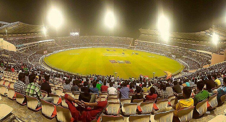
Photo: Jms1241, CC BY-SA 4.0.
The Rajiv Gandhi International Cricket Stadium, commonly known as Uppal Stadium, is an international cricket stadium in Hyderabad, Telangana, India. It is owned and operated by Hyderabad Cricket Association. Rajiv Gandhi International Cricket Stadium is situated 2½ km northeast of Sana High School.
Kacheguda railway station
Railway station

Photo: World8115, CC BY-SA 3.0.
Kacheguda railway station is a non-suburban-2 category Indian railway station in Hyderabad railway division of South Central Railway zone. It is one of the four major railway stations in Hyderabad of the Indian state of Telangana. Kacheguda railway station is situated 3 km west of Sana High School.
Vidyanagar railway station
Railway stop
 Vidyanagar railway station is a sub-urban 3 category railway station in the Hyderabad railway division of South Central Railway zone. It lies in the suburbs of Hyderabad in the Indian state of Telangana. Vidyanagar railway station is situated 2 km northwest of Sana High School.
Places in the Area
Nearby places include Vidyanagar and Adikmet.
Vidyanagar
Suburb

Photo: Adityamadhav83, CC BY-SA 3.0.
Vidyanagar is a locality of Hyderabad, Telangana, India. It formed Ward No. 86 of Greater Hyderabad Municipal Corporation.
Adikmet
Neighborhood
Adikmet is an urban locality in Hyderabad, India. Mainly a residential area, it is very close to Osmania University's campus. The neighbourhood has a hanuman temple and is located near the road from Nallakunta to Tarnaka.
Nallakunta
Suburb
Nallakunta is a neighbourhood in Hyderabad, in the state of Telangana, India. Nallakunta is situated 2½ km west of Sana High School.
Sana High School
- Type: University
- Address: 2-3-512/27/93/A, Bapu Nagar, Amberpet, Hyderabad, Telangana 500013
- Category: education
- Location: Uppal, Medchal Malkajgiri, Telangana, Southern India, India, South Asia, Asia
- View on OpenStreetMap
Latitude
17.39452° or 17° 23′ 40″ northLongitude
78.52883° or 78° 31′ 44″ eastOpen location code
7J9W9GVH+RGOpenStreetMap ID
node 7372921903OpenStreetMap feature
amenity=university
This page is based on OpenStreetMap, Wikidata, and Wikimedia Commons.
We’d love your help improving our open data sources. Thank you for contributing.
Satellite Map
Discover Sana High School from above in high-definition satellite imagery.
Notable Places Nearby
Highlights include Jawaharlal Nehru Polytechnic College Grounds and Janani infertility center.
Nearby Places
Explore places such as Sri Vijaya Towers and Vishal Megamart.
Telangana: Must-Visit Destinations
Delve into Hyderabad, Central Hyderabad, Adilabad, and Nizamabad.
Curious Places to Discover
Uncover intriguing places from every corner of the globe.
About Mapcarta. Data © OpenStreetMap contributors and available under the Open Database License". Text is available under the CC BY-SA 4.0 license, except for photos, directions, and the map. Photo: Pranayraj1985, CC BY-SA 4.0.