Parkway Liquuor and Check Cashing
Parkway Liquuor and Check Cashing is a convenience store in City of Detroit, Wayne County, Michigan which is located on Plymouth Road. Parkway Liquuor and Check Cashing is situated nearby to Shiyloh Baptist Church, as well as near the sports venue Brennan Pools.| Tap on a place to explore it |
Places of Interest Nearby
Highlights include Bishop Borgess High School and Eliza Howell Park.
Bishop Borgess High School
School
Bishop Borgess High School was a Catholic secondary school in the Detroit suburb of Redford, Michigan. Named after Caspar Henry Borgess, the second Roman Catholic bishop of Detroit, it was founded by the parishes of St. Bishop Borgess High School is situated 3,000 feet west of Parkway Liquuor and Check Cashing.
Eliza Howell Park
Park
Eliza Howell Park is a public park in Brightmoor, Detroit, Michigan. The park lies just north of Rouge Park and contains the confluence point between the upper and main Rouge River branches. Eliza Howell Park is situated 1½ miles north of Parkway Liquuor and Check Cashing.
Clara B. Ford Academy
School
Clara B. Ford Academy is a charter school located in the city of Dearborn Heights, Michigan. The school is located at 20651 West Warren Avenue. The Sisters of the Good Shepherd ran a Detroit area outreach program for young women and in the 1930s began fundraising with the Salvation Army for a large campus. Clara B. Ford Academy is situated 2½ miles southeast of Parkway Liquuor and Check Cashing.
Places in the Area
Nearby places include Brightmoor and Redford.
Brightmoor
Neighborhood

Photo: Notorious4life, Public domain.
Brightmoor is a neighborhood located in Detroit, Michigan, near the northwest border of the city. Brightmoor is defined by the Brightmoor Alliance as being bordered by Puritan Avenue to the north, the CSX railway to the south, Evergreen Road to the east, and West Outer Drive, Dacosta Street, and Telegraph Road to the west. Brightmoor is situated 1½ miles north of Parkway Liquuor and Check Cashing.
Redford
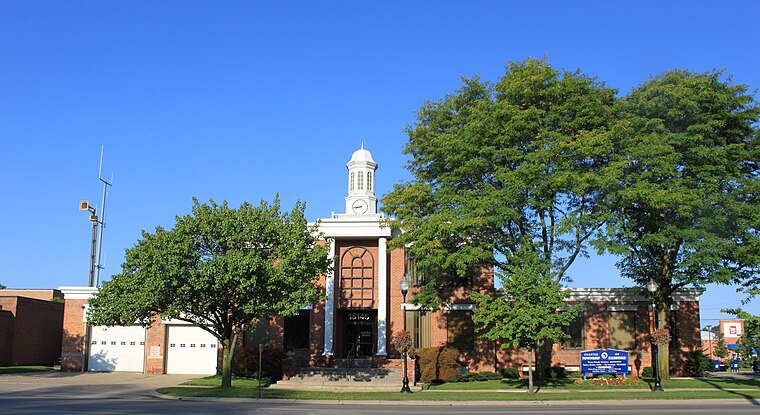
Photo: Dwight Burdette, CC BY 3.0.
Redford Township is a charter township in Wayne County in the U.S. state of Michigan. An inner-ring suburb of Detroit, Redford borders Livonia to the west and Detroit to the east, roughly 15 miles northwest of downtown Detroit.
Warrendale
Suburb
Warrendale is a neighborhood located in Detroit, Michigan, bordered by Greenfield Road, Joy Road, and the Detroit city limits. Warrendale neighbors Dearborn on two sides and Dearborn Heights on another side. Warrendale is situated 2½ miles southeast of Parkway Liquuor and Check Cashing.
Parkway Liquuor and Check Cashing
- Type: Convenience store
- Address: 22443 Plymouth Road, Detroit, MI 48239
- Categories: shop and food
- Location: City of Detroit, Wayne County, Michigan, Midwest, United States, North America
- View on OpenStreetMap
Latitude
42.37138° or 42° 22′ 17″ northLongitude
-83.26192° or 83° 15′ 43″ westOpen location code
86JR9PCQ+H6OpenStreetMap ID
node 7387765046OpenStreetMap feature
shop=convenience
This page is based on OpenStreetMap, Wikidata, and Wikimedia Commons.
We’d love your help improving our open data sources. Thank you for contributing.
Satellite Map
Discover Parkway Liquuor and Check Cashing from above in high-definition satellite imagery.
Notable Places Nearby
Highlights include Shiyloh Baptist Church and Brennan Pools.
Nearby Places
Explore places such as Prince Pizza and Plymouth / Outer Dr (WB).
Wayne County: Must-Visit Destinations
Delve into Detroit, Dearborn, Downtown Detroit, and Livonia.
Curious Convenience Stores to Discover
Uncover intriguing convenience stores from every corner of the globe.
About Mapcarta. Data © OpenStreetMap contributors and available under the Open Database License". Text is available under the CC BY-SA 4.0 license, except for photos, directions, and the map. Photo: Wikimedia, CC0.