Paradero Camiones a La Joya / Tasqueña
Paradero Camiones a La Joya / Tasqueña is a bus station in Mexico City, Central Mexico. Paradero Camiones a La Joya / Tasqueña is situated nearby to the health club GIMNASIO, as well as near the golf course Club de Golf México.| Tap on a place to explore it |
Places of Interest Nearby
Highlights include Estadio Azteca and Salvador Zubirán National Institute of Health Sciences and Nutrition.
Estadio Azteca
Stadium

Photo: Wikimedia, CC BY-SA 4.0.
Estadio Azteca is a football stadium located in Coyoacán, Mexico City. It is the official home of football team Club América, as well as the Mexico national team. Estadio Azteca is situated 3½ km north of Paradero Camiones a La Joya / Tasqueña.
Salvador Zubirán National Institute of Health Sciences and Nutrition
Hospital

Photo: ProtoplasmaKid, CC BY-SA 4.0.
The Salvador Zubirán National Institute of Health Sciences and Nutrition is one of the twelve national institutes that belong to the Mexican Secretariat of Health. Salvador Zubirán National Institute of Health Sciences and Nutrition is situated 1½ km north of Paradero Camiones a La Joya / Tasqueña.
Instituto Nacional de Rehabilitación
Hospital
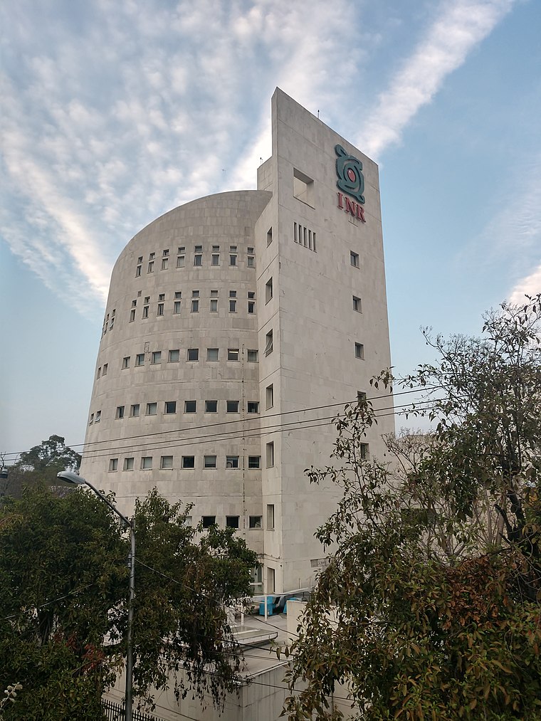
Photo: ProtoplasmaKid, CC BY-SA 4.0.
Instituto Nacional de Rehabilitación is a public institution that belongs to Mexico's Secretariat of Health, specializing in physical rehabilitation. The institute is funded by Mexico's Federal Government. Instituto Nacional de Rehabilitación is situated 2 km north of Paradero Camiones a La Joya / Tasqueña.
Places in the Area
Nearby places include Tlalpan and Santa Úrsula Xitla.
Tlalpan

Photo: Wikimedia, CC BY-SA 1.0.
Tlalpan and Pedregal is a district of Mexico City. Tlalpan is best known as the location of most hospitals in Mexico City and its most natural parks. Pedregal is a wealthy residential area built on top of and using lava rock from the Xitle volcano.
Santa Úrsula Xitla
Quarter

Photo: Lore Colorado, CC BY-SA 4.0.
Santa Úrsula Xitla is a quarter, which is situated 2½ km west of Paradero Camiones a La Joya / Tasqueña.
San Andrés Totoltepec
Quarter

Photo: Fotoguia, CC BY-SA 3.0.
San Andrés Totoltepec is a community in the borough of Tlalpan, Mexico City, Mexico. The name contains the Nahuatl elements totol and tepetl. Peterson Schools has its Tlalpan campus in San Andrés Totoltepec. San Andrés Totoltepec is situated 3 km southwest of Paradero Camiones a La Joya / Tasqueña.
Paradero Camiones a La Joya / Tasqueña
- Type: Bus station
- Categories: station and transportation
- Location: Mexico City, Central Mexico, Mexico, North America
- View on OpenStreetMap
Latitude
19.27303° or 19° 16′ 23″ northLongitude
-99.15491° or 99° 9′ 18″ westOpen location code
76F27RFW+62OpenStreetMap ID
node 7396405042OpenStreetMap feature
amenity=bus_stationOpenStreetMap feature
public_transport=station
This page is based on OpenStreetMap, Wikidata, and Wikimedia Commons.
We’d love your help improving our open data sources. Thank you for contributing.
Satellite Map
Discover Paradero Camiones a La Joya / Tasqueña from above in high-definition satellite imagery.
Notable Places Nearby
Highlights include GIMNASIO and Club de Golf México.
Nearby Places
Explore places such as Panadería and Verdulería.
Mexico City: Must-Visit Destinations
Delve into Centro, Xochimilco, Coyoacán, and Condesa and Roma.
Curious Bus Stations to Discover
Uncover intriguing bus stations from every corner of the globe.
About Mapcarta. Data © OpenStreetMap contributors and available under the Open Database License". Text is available under the CC BY-SA 4.0 license, except for photos, directions, and the map. Photo: Wikimedia, CC BY 2.0.