The Mesa
The Mesa is a scenic viewpoint in Los Angeles, Southern California, California. The Mesa is situated nearby to the peak Cerro Negro, as well as near the scenic viewpoint Ultimate Destination.| Tap on a place to explore it |
Places of Interest Nearby
Highlights include Descanso Gardens and Lanterman House.
Descanso Gardens
Garden
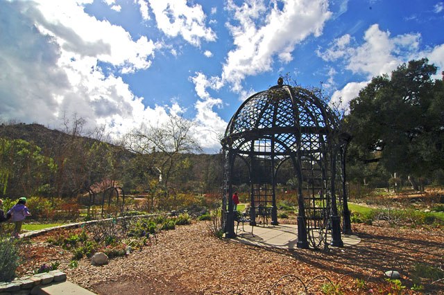
Photo: DaveofCali, CC BY-SA 3.0.
Descanso Gardens is a 150-acre botanical garden located in La Cañada Flintridge, Los Angeles County, California. It sits on the northern edge of the San Rafael Hills.
Lanterman House
Historic building

Photo: Cbl62, CC BY-SA 3.0.
Lanterman House is a bungalow-style historic house museum in La Cañada Flintridge, California on the National Register of Historic Places. The house was commissioned by Dr. Lanterman House is situated 1¼ miles north of The Mesa.
Jet Propulsion Laboratory
Research institute

Photo: NASA, Public domain.
The Jet Propulsion Laboratory is a federally funded research and development center in La Cañada Flintridge, California, Crescenta Valley, United States. Jet Propulsion Laboratory is situated 2 miles northeast of The Mesa.
Places in the Area
Nearby places include La Cañada Flintridge and Altacanyada.
La Cañada Flintridge

Photo: Doc Searls, CC BY 2.0.
La Cañada Flintridge is a city of about 20,000 people at the extreme northwest end of the San Gabriel Valley in Southern California.
Altacanyada
Hamlet
La Cañada Flintridge, commonly known as just La Cañada, is a city in the foothills of the Verdugo Mountains in Los Angeles County, California, United States. Altacanyada is situated 2½ miles north of The Mesa.
La Crescenta-Montrose
Suburb

Photo: Doc Searls, CC BY 2.0.
La Crescenta-Montrose is an unincorporated area in Los Angeles County, California, United States. The community is bordered by Glendale to the south and west, La Cañada Flintridge to the east, and Angeles National Forest to the north. La Crescenta-Montrose is situated 3½ miles northwest of The Mesa.
The Mesa
- Type: Scenic viewpoint
- Category: tourism
- Location: Los Angeles, Southern California, California, United States, North America
- View on OpenStreetMap
Latitude
34.18828° or 34° 11′ 18″ northLongitude
-118.2082° or 118° 12′ 30″ westOpen location code
85635QQR+8POpenStreetMap ID
node 7428071398OpenStreetMap feature
tourism=viewpoint
This page is based on OpenStreetMap, Wikidata, and Wikimedia Commons.
We’d love your help improving our open data sources. Thank you for contributing.
Satellite Map
Discover The Mesa from above in high-definition satellite imagery.
Places with the Same Name
Discover other places named “The Mesa”.
Notable Places Nearby
Highlights include Cerro Negro and Ultimate Destination.
Nearby Places
Explore places such as Redwood Rest and El Portal.
Los Angeles: Must-Visit Destinations
Delve into Hollywood, San Gabriel Valley, San Fernando Valley, and Long Beach.
Curious Scenic Viewpoints to Discover
Uncover intriguing scenic viewpoints from every corner of the globe.
About Mapcarta. Data © OpenStreetMap contributors and available under the Open Database License". Text is available under the CC BY-SA 4.0 license, except for photos, directions, and the map. Photo: Mfield, CC BY-SA 3.0.