Le Chaudron Coop
Le Chaudron Coop is a supermarket in Versailles, Yvelines, Île-de-France which is located on Avenue de Louveciennes. Access is restricted and requires permission. Le Chaudron Coop is situated nearby to the playground Aire de jeux pour enfants, as well as near the pitch Stade de Rugby Corneille.| Tap on a place to explore it |
- Access is restricted and requires permission.
- Email: com@lechaudroncoop.fr
- Type: Supermarket
- Address: 5 Avenue de Louveciennes, 78150
Places of Interest Nearby
Highlights include Town hall of Le Chesnay-Rocquencourt and Chapelle Saint-Joseph de Glatigny.
Town hall of Le Chesnay-Rocquencourt
Town hall
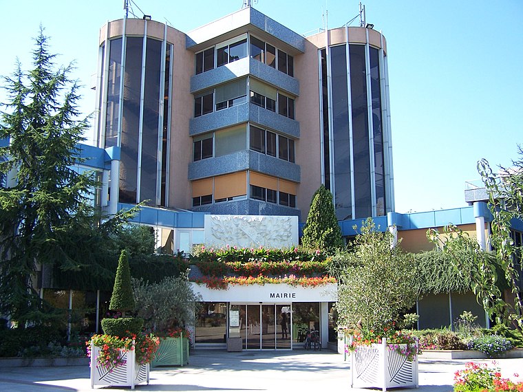
Photo: Henrysalome, CC BY-SA 3.0.
Town hall of Le Chesnay-Rocquencourt is situated 1 km west of Le Chaudron Coop.
Chapelle Saint-Joseph de Glatigny
Church

Photo: Chabe01, CC BY-SA 4.0.
Chapelle Saint-Joseph de Glatigny is a church, which is situated 610 metres southeast of Le Chaudron Coop.
Église Saint-Antoine de Padoue du Chesnay
Church

Photo: Henrysalome, CC BY-SA 3.0.
Église Saint-Antoine de Padoue du Chesnay is a church, which is situated 1 km southwest of Le Chaudron Coop.
Places in the Area
Nearby places include Le Chesnay and Le Chesnay-Rocquencourt.
Le Chesnay
Suburb
Photo: Henrysalome, CC BY-SA 3.0.
Le Chesnay is a former commune in the Yvelines department in the Île-de-France region in north-central France. On 1 January 2019, it was merged into the new commune Le Chesnay-Rocquencourt.
Le Chesnay-Rocquencourt
Town
Photo: Henrysalome, CC BY-SA 3.0.
Le Chesnay-Rocquencourt is a commune in the western suburbs of Paris, in the department of Yvelines. It was established on 1 January 2019 from the amalgamation of the communes of Le Chesnay and Rocquencourt.
Hameau de la Reine
Locality

Photo: Daderot, CC BY-SA 3.0.
The Hameau de la Reine is a rustic retreat in the park of the Château de Versailles built for Marie Antoinette in 1783 near the Petit Trianon in Yvelines, France.
Le Chaudron Coop
- Categories: shop and food
- Location: Versailles, Arrondissement of Versailles, Yvelines, Île-de-France, France, Europe
- View on OpenStreetMap
Latitude
48.82644° or 48° 49′ 35″ northLongitude
2.13763° or 2° 8′ 16″ eastOperator
Le Chaudron CoopOpen location code
8FW4R4GQ+H3OpenStreetMap ID
node 7448852011OpenStreetMap feature
shop=supermarket
This page is based on OpenStreetMap, Wikidata, and Wikimedia Commons.
We’d love your help improving our open data sources. Thank you for contributing.
Satellite Map
Discover Le Chaudron Coop from above in high-definition satellite imagery.
Notable Places Nearby
Highlights include Aire de jeux pour enfants and Stade de Rugby Corneille.
Nearby Places
Explore places such as Martin Luther King and U express.
Île-de-France: Must-Visit Destinations
Delve into Paris, Boulogne-Billancourt, Paris Charles de Gaulle Airport, and Fontainebleau.
Curious Supermarkets to Discover
Uncover intriguing supermarkets from every corner of the globe.
About Mapcarta. Data © OpenStreetMap contributors and available under the Open Database License". Text is available under the CC BY-SA 4.0 license, except for photos, directions, and the map. Photo: PS-2507, CC BY 3.0.