St-Anthelme
St-Anthelme is in Chignin, Arrondissement of Chambéry, Auvergne-Rhône-Alpes. St-Anthelme is situated nearby to the castle Clos Saint-Anthelme, as well as near the archaeological site Site archéologique des Tours de Chignin.| Tap on a place to explore it |
Places of Interest Nearby
Highlights include Église Saint-Georges du Prieuré and Sanctuaire Notre-Dame de Myans.
Église Saint-Georges du Prieuré
Church

Photo: Wikimedia, CC BY-SA 4.0.
Église Saint-Georges du Prieuré is a church, which is situated 1¼ km northwest of St-Anthelme.
Sanctuaire Notre-Dame de Myans
Church
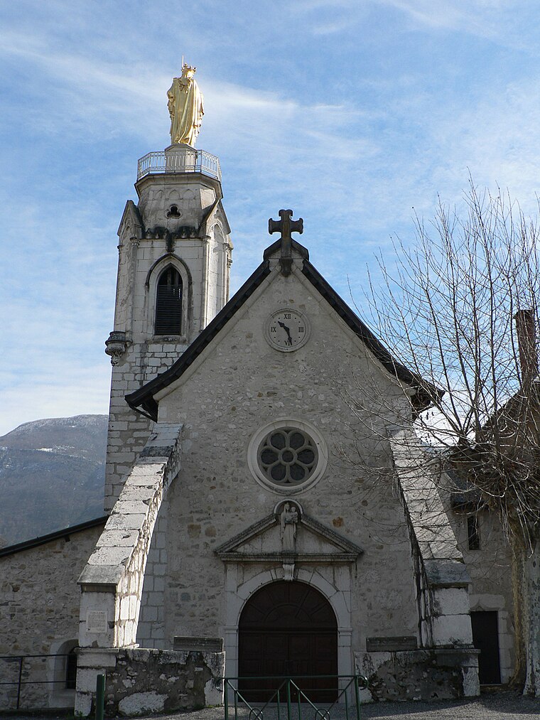
Photo: Badhy, CC BY-SA 4.0.
Sanctuaire Notre-Dame de Myans is a church, which is situated 1½ km southwest of St-Anthelme.
Roc de Tormery
Scenic viewpoint

Photo: Wikimedia, CC BY-SA 3.0.
Roc de Tormery is a scenic viewpoint, which is situated 2½ km east of St-Anthelme.
Places in the Area
Nearby places include La Thuile and Curienne.
La Thuile
Village

Photo: Wikimedia, CC BY-SA 3.0.
La Thuile is a commune in the Savoie department in the Auvergne-Rhône-Alpes region in south-eastern France. La Thuile is situated 4 km east of St-Anthelme.
Curienne
Village

Photo: Wikimedia, CC BY-SA 3.0.
Curienne is a commune in the Savoie department in the Auvergne-Rhône-Alpes region in Southeastern France. In 2019, it had a population of 678. Curienne is situated 4½ km north of St-Anthelme.
Montmélian
Village

Photo: Wikimedia, CC BY-SA 3.0.
Montmélian is a commune in the Savoie department in the Auvergne-Rhône-Alpes region in south-eastern France. Montmélian station has rail connections to Grenoble, Modane, Bourg-Saint-Maurice and Chambéry. Montmélian is situated 5 km southeast of St-Anthelme.
St-Anthelme
- Type: Sign
- Categories: information and tourism
- Location: Chignin, Arrondissement of Chambéry, Savoie, Auvergne-Rhône-Alpes, France, Europe
- View on OpenStreetMap
Latitude
45.52482° or 45° 31′ 29″ northLongitude
6.00303° or 6° 0′ 11″ eastElevation
407 metres (1,335 feet)Operator
CA Grand ChambéryOpen location code
8FQ8G2F3+W6OpenStreetMap ID
node 7598226987OpenStreetMap feature
tourism=information
This page is based on OpenStreetMap, Wikidata, and Wikimedia Commons.
We’d love your help improving our open data sources. Thank you for contributing.
Satellite Map
Discover St-Anthelme from above in high-definition satellite imagery.
Notable Places Nearby
Highlights include Clos Saint-Anthelme and Site archéologique des Tours de Chignin.
Nearby Places
Explore places such as Notre-Dame des Champs et des Vignes and La Poype.
Savoie: Must-Visit Destinations
Delve into Chambéry, Aix-les-Bains, Val-d’Isère, and Bourg-Saint-Maurice.
Curious Places to Discover
Uncover intriguing places from every corner of the globe.
About Mapcarta. Data © OpenStreetMap contributors and available under the Open Database License". Text is available under the CC BY-SA 4.0 license, except for photos, directions, and the map. Photo: Mrhugues, CC BY-SA 3.0.