Aussichtspunkt Reichsburg Cochem
Aussichtspunkt Reichsburg Cochem is a scenic viewpoint in Rhineland-Palatinate, Germany. Aussichtspunkt Reichsburg Cochem is situated nearby to the winery Weingut Winzerhof Haxel, as well as near the community center Evangelisches Gemeindezentrum.| Tap on a place to explore it |
Places of Interest Nearby
Highlights include Enderttor and Apollo.
Enderttor
City gate
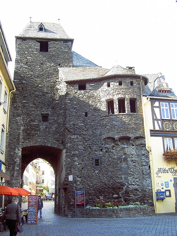 Enderttor is a city gate, which is situated 510 metres east of Aussichtspunkt Reichsburg Cochem.
Apollo
Movie theater
 Apollo is a movie theater, which is situated 470 metres east of Aussichtspunkt Reichsburg Cochem.
Martin-von-Cochem-Gymnasium
School

Photo: Wikimedia, CC BY-SA 4.0.
Martin-von-Cochem-Gymnasium is a school, which is situated 570 metres southeast of Aussichtspunkt Reichsburg Cochem.
Places in the Area
Nearby places include Cochem and Cochem Castle.
Cochem

Photo: Michal Osmenda, CC BY-SA 2.0.
Cochem is a traditional German town with half-timbered houses and an exceptionally scenic location on the Mosel river in Rhineland-Palatinate, Germany. The town is home to about 5,700 people, and has and a population of 8,700 in a 7 km radius.


Aussichtspunkt Reichsburg Cochem
- Type: Scenic viewpoint
- Category: tourism
- Location: Rhineland-Palatinate, Germany, Central Europe, Europe
- View on OpenStreetMap
Latitude
50.14598° or 50° 8′ 46″ northLongitude
7.15821° or 7° 9′ 30″ eastOpen location code
9F2945W5+97OpenStreetMap ID
node 7602849586OpenStreetMap feature
tourism=viewpoint
This page is based on OpenStreetMap, Wikidata, and Wikimedia Commons.
We’d love your help improving our open data sources. Thank you for contributing.
Satellite Map
Discover Aussichtspunkt Reichsburg Cochem from above in high-definition satellite imagery.
Notable Places Nearby
Highlights include Weingut Winzerhof Haxel and Evangelisches Gemeindezentrum.
Nearby Places
Explore places such as Cochem, Kelberger Straße and Station Cochem Kahnstraße.
Rhineland-Palatinate: Must-Visit Destinations
Delve into Mainz, Trier, Koblenz, and Worms.
Curious Scenic Viewpoints to Discover
Uncover intriguing scenic viewpoints from every corner of the globe.
About Mapcarta. Data © OpenStreetMap contributors and available under the Open Database License". Text is available under the CC BY-SA 4.0 license, except for photos, directions, and the map. Photo: Traveler100, CC BY-SA 3.0.