Gruta de Santa Luzia
Gruta de Santa Luzia is a cave in Mauá, São Paulo. Gruta de Santa Luzia is situated nearby to the park Parque Ecológico da Gruta Santa Luzia, as well as near the spring Nascente do Rio Tamanduateí.| Tap on a place to explore it |
Places in the Area
Nearby places include Rio Grande da Serra and Recreio da Borda do Campo.
Rio Grande da Serra
Town

Photo: Diego Torres Silvestre, CC BY 2.0.
Rio Grande da Serra is a municipality in the state of São Paulo in Brazil. It is located approximately 49 kilometres by road southeast of the centre of the city of São Paulo. Rio Grande da Serra is situated 8 km south of Gruta de Santa Luzia.
Recreio da Borda do Campo
Suburb

Photo: BêS, CC BY-SA 3.0.
Recreio da Borda do Campo is a suburb, which is situated 9 km southwest of Gruta de Santa Luzia.
Jardim Ipanema
Suburb
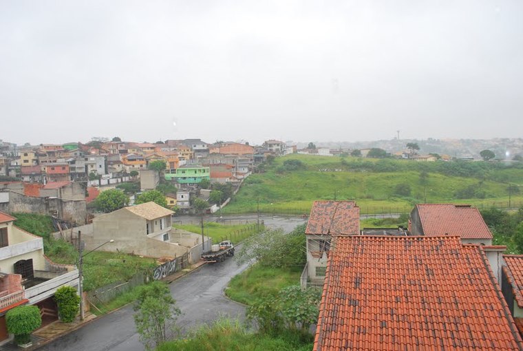
Photo: Manoel Messias de So…, CC BY-SA 3.0.
Jardim Ipanema is a suburb, which is situated 10 km west of Gruta de Santa Luzia.
Gruta de Santa Luzia
- Type: Cave
- Categories: tourist attraction and landform
- Location: Mauá, São Paulo, Southeast, Brazil, South America
- View on OpenStreetMap
Latitude
-23.67773° or 23° 40′ 40″ southLongitude
-46.40863° or 46° 24′ 31″ westOpen location code
588M8HCR+WGOpenStreetMap ID
node 7617029114OpenStreetMap feature
attraction=yesOpenStreetMap feature
natural=cave_entrance
This page is based on OpenStreetMap, Wikidata, and Wikimedia Commons.
We’d love your help improving our open data sources. Thank you for contributing.
Satellite Map
Discover Gruta de Santa Luzia from above in high-definition satellite imagery.
Notable Places Nearby
Highlights include Parque Ecológico da Gruta Santa Luzia and Nascente do Rio Tamanduateí.
Nearby Places
Explore places such as Escola Estadual Dona Esperança de Oliveira Saavedra and Escola Municipal Doutora Darci Aparecida Fincatti Fornari.
São Paulo: Must-Visit Destinations
Delve into São Paulo, Osasco, Santos, and Campinas.
Curious Caves to Discover
Uncover intriguing caves from every corner of the globe.
About Mapcarta. Data © OpenStreetMap contributors and available under the Open Database License". Text is available under the CC BY-SA 4.0 license, except for photos, directions, and the map. Photo: Wikimedia, CC BY-SA 3.0.