Birch Bread
Birch Bread is a bakery in Pangbourne, West Berkshire, England which is located on Reading Road. Birch Bread is situated nearby to Pangbourne Post Office, as well as near Pangbourne Library.| Tap on a place to explore it |
Places of Interest Nearby
Highlights include Church of St James the Less and Pangbourne railway station.
Church of St James the Less
Church

Photo: Bill Nicholls, CC BY-SA 2.0.
Church of St James the Less is situated 650 feet west of Birch Bread.
Pangbourne railway station
Railway station

Photo: Chris j wood, CC BY-SA 4.0.
Pangbourne railway station serves the village of Pangbourne in the county of Berkshire, and across the River Thames the village of Whitchurch-on-Thames, in Oxfordshire. Pangbourne railway station is situated 1,300 feet northwest of Birch Bread.
Whitchurch Lock
Lock

Photo: Nancy, CC BY-SA 3.0.
Whitchurch Lock is a lock and weir on the River Thames in England. It is a pound lock, built by the Thames Navigation Commissioners in 1787. It is on an island near the Oxfordshire village of Whitchurch-on-Thames and is accessible only by boat. Whitchurch Lock is situated 1,300 feet northwest of Birch Bread.
Places in the Area
Nearby places include Pangbourne and Tidmarsh.
Pangbourne
Village
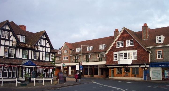
Photo: Chris j wood, CC BY-SA 4.0.
Reading is a large, historic town in Berkshire in the South East of England. It is one of the largest towns without city status in the United Kingdom with just under 235,000 inhabitants.
Tidmarsh
Village

Photo: Pam Brophy, CC BY-SA 2.0.
Tidmarsh is a village in West Berkshire, England. Its development is mainly residential and agricultural, and is centred on the A340 road between Pangbourne and Theale.
Sulham
Hamlet

Photo: Brendan and Ruth McCartney, CC BY-SA 2.0.
Sulham is a village in West Berkshire, England. The larger village of Tidmarsh is adjacent to Sulham on the west side, with Tilehurst on the east side.
Birch Bread
- Type: Bakery
- Address: 16 Reading Road, Pangbourne, Reading, RG8 7LY
- Categories: shop and food
- Location: Pangbourne, West Berkshire, England, United Kingdom, Britain and Ireland, Europe
- View on OpenStreetMap
Latitude
51.4837° or 51° 29′ 1″ northLongitude
-1.0853° or 1° 5′ 7″ westOpen location code
9C3WFWM7+FVOpenStreetMap ID
node 7624072682OpenStreetMap feature
shop=bakery
This page is based on OpenStreetMap, Wikidata, and Wikimedia Commons.
We’d love your help improving our open data sources. Thank you for contributing.
Satellite Map
Discover Birch Bread from above in high-definition satellite imagery.
Notable Places Nearby
Highlights include Pangbourne Post Office and Pangbourne Library.
Nearby Places
Explore places such as Costa and Davistate.
England: Must-Visit Destinations
Delve into London, Manchester, Sheffield, and Leeds.
Curious Bakeries to Discover
Uncover intriguing bakeries from every corner of the globe.
About Mapcarta. Data © OpenStreetMap contributors and available under the Open Database License". Text is available under the CC BY-SA 4.0 license, except for photos, directions, and the map. Photo: sidibousaid, CC BY 2.0.