Plant’s Fish and Chip Shop
Plant’s Fish and Chip Shop is a fast food restaurant in Coxhoe, County Durham, England. Plant’s Fish and Chip Shop is situated nearby to the community center Quarrington Hill Community Centre, as well as near the protected area Quarrington Hill Grasslands SSSI.| Tap on a place to explore it |
Places of Interest Nearby
Highlights include Coxhoe Hall and Coxhoe War Memorial.
Coxhoe Hall
Ruins

Photo: peter robinson, CC BY-SA 2.0.
Coxhoe Hall is a ruins, which is situated 1 mile south of Plant’s Fish and Chip Shop.
Coxhoe War Memorial
Memorial
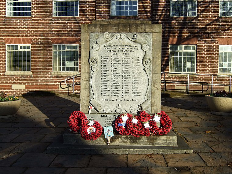
Photo: JThomas, CC BY-SA 2.0.
Coxhoe War Memorial is situated 1¼ miles southwest of Plant’s Fish and Chip Shop.
Christ the King
Church

Photo: Trevor Littlewood, CC BY-SA 2.0.
Christ the King is a church, which is situated 2 miles west of Plant’s Fish and Chip Shop.
Places in the Area
Nearby places include Quarrington Hill and Kelloe.
Quarrington Hill
Village

Photo: peter robinson, CC BY-SA 2.0.
Quarrington Hill is a village in County Durham, in England. It is situated a short distance to the north of Kelloe. Having been part of the extensive parish of Kelloe, it merged with the village of Cassop during the 19th century to form the parish of Cassop-cum-Quarrington, it is now in the parish of Coxhoe.
Kelloe
Village

Photo: peter robinson, CC BY-SA 2.0.
Kelloe is a village and civil parish in County Durham, England. The population of the civil parish as taken at the 2011 Census was 1,502. It is situated to the south-east of Durham.
Cassop
Village

Photo: Oliver Dixon, CC BY-SA 2.0.
Cassop is a village and former civil parish, now in the parish of Cassop-cum-Quarrington, in the County Durham district, in the ceremonial county of Durham, England.
Plant’s Fish and Chip Shop
- Type: Fast food restaurant
- Cuisine: fish and chips
- Categories: food and restaurant
- Location: Coxhoe, County Durham, North East England, England, United Kingdom, Britain and Ireland, Europe
- View on OpenStreetMap
Latitude
54.72994° or 54° 43′ 48″ northLongitude
-1.47991° or 1° 28′ 48″ westElevation
531 feet (162 metres)Open location code
9C6WPGHC+X2OpenStreetMap ID
node 763662514OpenStreetMap feature
amenity=fast_foodOpenStreetMap attribute
cuisine=fish_and_chips
This page is based on OpenStreetMap, Wikidata, and Wikimedia Commons.
We’d love your help improving our open data sources. Thank you for contributing.
Satellite Map
Discover Plant’s Fish and Chip Shop from above in high-definition satellite imagery.
Notable Places Nearby
Highlights include Quarrington Hill Community Centre and Quarrington Hill Grasslands SSSI.
Nearby Places
Explore places such as Quarrington Hill Social Club and Working Mens Club.
County Durham: Must-Visit Destinations
Delve into Durham, Darlington, Hartlepool, and Stockton-on-Tees.
Curious Fast Food Restaurants to Discover
Uncover intriguing fast food restaurants from every corner of the globe.
About Mapcarta. Data © OpenStreetMap contributors and available under the Open Database License". Text is available under the CC BY-SA 4.0 license, except for photos, directions, and the map. Photo: Roberto Strauss, CC BY 2.0.