Clay Copse
Clay Copse is a forest in Goring Heath, South Oxfordshire District, England. Clay Copse is situated nearby to the suburb Little Heath, as well as near Tilehurst.| Tap on a place to explore it |
Places of Interest
Highlights include Tilehurst railway station and Calcot Park.
Tilehurst railway station
Railway station

Photo: Chris j wood, CC BY-SA 3.0.
Tilehurst railway station serves the suburb and village of Tilehurst, west of Reading, Berkshire, England. The station is on the extreme northern edge of Tilehurst and at a much lower level than most of that suburb.
Calcot Park
Golf course
Calcot Park is a country house, estate, and golf club in the English county of Berkshire. It is situated between Calcot and Tilehurst, suburbs of the town of Reading, and within the civil parish of Tilehurst. It is north of the Bath Road.
Mapledurham House

Photo: Motmit, CC BY-SA 3.0.
Mapledurham House is an Elizabethan stately home located in the civil parish of Mapledurham in the English county of Oxfordshire. It is a Grade I listed building, first listed on 24 October 1951.
Places in the Area
Nearby places include Reading and Calcot.
Reading

Photo: Wikimedia, CC BY-SA 2.0.
Reading is a large, historic town in Berkshire in the South East of England. It is one of the largest towns without city status in the United Kingdom with just under 235,000 inhabitants.
Calcot
Suburb
Calcot, or Calcot Row, is a village in West Berkshire, England. Calcot is within the built-up area of Reading, located about 3 miles out of the town centre, and straddles the historic A4 Bath Road.
Pangbourne
Village
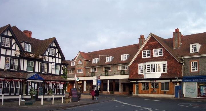
Photo: Chris j wood, CC BY-SA 4.0.
Reading is a large, historic town in Berkshire in the South East of England. It is one of the largest towns without city status in the United Kingdom with just under 235,000 inhabitants.
Clay Copse
Latitude
51.4619° or 51° 27′ 43″ northLongitude
-1.0565° or 1° 3′ 23″ westOpen location code
9C3WFW6V+QCOpenStreetMap ID
node 7641111242OpenStreetMap feature
natural=wood
This page is based on OpenStreetMap, Wikidata, and Wikimedia Commons.
We’d love your help improving our open data sources. Thank you for contributing.
Satellite Map
Discover Clay Copse from above in high-definition satellite imagery.
Places with the Same Name
Discover other places named “Clay Copse”.
Localities in the Area
Explore places such as Little Heath and Tilehurst.
Notable Places Nearby
Highlights include Cornwell Copse and Hall Place Equestrian Centre.
Oxfordshire: Must-Visit Destinations
Delve into Oxford, Abingdon-on-Thames, Banbury, and Woodstock.
Curious Forests to Discover
Uncover intriguing forests from every corner of the globe.
About Mapcarta. Data © OpenStreetMap contributors and available under the Open Database License". Text is available under the CC BY-SA 4.0 license, except for photos, directions, and the map. Photo: Wikimedia, CC0.