Talaba
Talaba is a bus stop in Bacoor, Cavite, Calabarzon. Talaba is situated nearby to the government office Bureau of Fire Protection, as well as near Bacoor Police Station.| Tap on a place to explore it |
Places of Interest Nearby
Highlights include Zapote Bridge and Battle of Zapote.
Zapote Bridge
Bridge
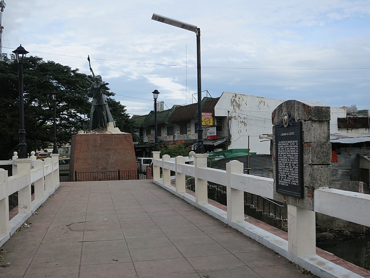
Photo: Seav, CC BY-SA 4.0.
The Zapote Bridge is a stone arch pedestrian bridge crossing the Zapote River in the Philippines. It connects the cities of Las Piñas in Metro Manila and Bacoor in the province of Cavite. Zapote Bridge is situated 770 metres east of Talaba.
Battle of Zapote
Memorial
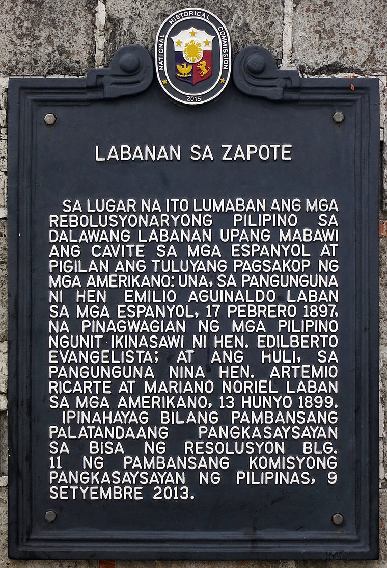 Battle of Zapote is a memorial, which is situated 770 metres east of Talaba.
Las Piñas General Hospital and Satellite Trauma Center
Hospital
The Las Piñas General Hospital and Satellite Trauma Center is a tertiary level government hospital in the Philippines with an authorized bed capacity of five hundred. Las Piñas General Hospital and Satellite Trauma Center is situated 2 km northeast of Talaba.
Places in the Area
Nearby places include Las Piñas and BF International Village.
Las Piñas

Photo: Charles Boris Manez, CC BY-SA 3.0.
Las Piñas (, officially the City of Las Piñas, is a highly urbanized city in the National Capital Region of the Philippines. According to the 2024 census, it has a population of 615,549 people.
BF International Village
Quarter
BF International Village is a barangay in the first district of Las Piñas, Metro Manila, Philippines. As of 2020, BF International Village has a population of 77,264 people spread over 2.17 km2 of land. BF International Village is situated 4 km east of Talaba.
Imus

Photo: Aerous, CC BY-SA 3.0.
Imus is a city in Cavite, and the de jure capital of the province. The city is the site of Battle of Alapan, a major encounter during the Philippine Revolution on 1898.
Talaba
- Type: Bus stop
- Categories: transport stop and transportation
- Location: Bacoor, Cavite, Calabarzon, Luzon, Philippines, Southeast Asia, Asia
- View on OpenStreetMap
Latitude
14.46139° or 14° 27′ 41″ northLongitude
120.95971° or 120° 57′ 35″ eastOpen location code
7Q62FX65+HVOpenStreetMap ID
node 7674694075OpenStreetMap feature
public_transport=stop_position
This page is based on OpenStreetMap, Wikidata, and Wikimedia Commons.
We’d love your help improving our open data sources. Thank you for contributing.
Satellite Map
Discover Talaba from above in high-definition satellite imagery.
Places with the Same Name
Discover other places named “Talaba”.
Notable Places Nearby
Highlights include Talaba IV Barangay Hall and Talaba III Barangay Hall.
Nearby Places
Explore places such as Talaba and Mamihan & Paresan.
Cavite: Must-Visit Destinations
Delve into Tagaytay, Dasmariñas, Cavite City, and Imus.
Curious Bus Stops to Discover
Uncover intriguing bus stops from every corner of the globe.
About Mapcarta. Data © OpenStreetMap contributors and available under the Open Database License". Text is available under the CC BY-SA 4.0 license, except for photos, directions, and the map. Photo: Cookie Nguyen, CC BY-SA 4.0.