Sella di Favogna - Fenner Joch
Sella di Favogna - Fenner Joch is a locality in Trentino-Alto Adige, Northeast Italy and has an elevation of 1,563 metres. Sella di Favogna - Fenner Joch is situated nearby to the locality Cimoni, as well as near the hamlet al Buso.| Tap on a place to explore it |
Places of Interest
Highlights include Corno di Tres and Biotop Fennberger See - Biotopo Lago di Favogna.

Biotop Fennberger See - Biotopo Lago di Favogna
Nature reserve

Photo: Alessandro Gigliotti, CC BY 3.0.
Biotop Fennberger See - Biotopo Lago di Favogna is a nature reserve, which is situated 2½ km southeast of Sella di Favogna - Fenner Joch.
Fennberger See
Lake

Photo: Georgweis, CC BY-SA 4.0.
Fennberger See is a lake, which is situated 3 km southeast of Sella di Favogna - Fenner Joch.
Places in the Area
Nearby places include Vervò and Margreid an der Weinstraße.
Vervò
Village

Photo: Syrio, CC BY-SA 4.0.
Vervò was a comune in Trentino in the northern Italian region Trentino-Alto Adige/Südtirol, located about 25 kilometres north of Trento. As of 31 December 2004, it had a population of 694 and an area of 15.2 square kilometres. Vervò is situated 3½ km northwest of Sella di Favogna - Fenner Joch.
Margreid an der Weinstraße
Village
Margreid an der Weinstraße, often abbreviated to Margreid or Magrè, is a comune and a village in South Tyrol in northern Italy, located about 25 kilometres southwest of the city of Bolzano. Margreid an der Weinstraße is situated 4 km east of Sella di Favogna - Fenner Joch.
Roveré della Luna
Village
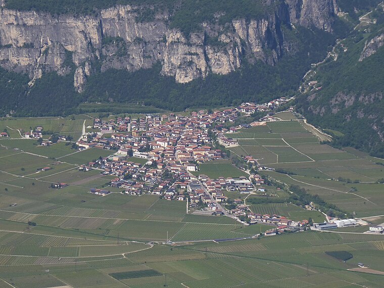
Photo: Syrio, CC BY-SA 4.0.
Roveré della Luna is a comune in Trentino in the northern Italian region Trentino-Alto Adige/Südtirol, located about 20 kilometres north of Trento. Roveré della Luna borders the following municipalities: Kurtatsch, Vervò, Margreid, Ton, Salorno and Mezzocorona. Roveré della Luna is situated 4½ km south of Sella di Favogna - Fenner Joch.
Sella di Favogna - Fenner Joch
- Type: Locality
- Category: mountain saddle
- Location: Trentino-Alto Adige, Northeast Italy, Italy, Europe
- View on OpenStreetMap
Latitude
46.28987° or 46° 17′ 24″ northLongitude
11.15507° or 11° 9′ 18″ eastElevation
1,563 metres (5,128 feet)Open location code
8FRH75Q4+W2OpenStreetMap ID
node 7713402570OpenStreetMap feature
natural=saddleOpenStreetMap feature
place=locality
This page is based on OpenStreetMap, Wikidata, and Wikimedia Commons.
We’d love your help improving our open data sources. Thank you for contributing.
Satellite Map
Discover Sella di Favogna - Fenner Joch from above in high-definition satellite imagery.
In Other Languages
From German to Italian—“Sella di Favogna - Fenner Joch” goes by many names.
- German: “Fenner Joch”
- Italian: “Sella di Favogna”
Places with the Same Name
Discover other places named “Sella di Favogna - Fenner Joch”.
Localities in the Area
Explore places such as Cimoni and al Buso.
Notable Places Nearby
Highlights include Pflanzenschutzgebiet Fenner Joch - Zona di Flora protetta Fenner Joch and Rappenkoflwand - Croda di Corvara.
Trentino-Alto Adige: Must-Visit Destinations
Delve into Bolzano, Trento, Brixen, and Merano.
Curious Localities to Discover
Uncover intriguing localities from every corner of the globe.
About Mapcarta. Data © OpenStreetMap contributors and available under the Open Database License". Text is available under the CC BY-SA 4.0 license, except for photos, directions, and the map. Photo: Wikimedia, CC BY-SA 3.0.