Walkern Village History
Walkern Village History is in Walkern, East Hertfordshire District, England. Walkern Village History is situated nearby to the sports venue Walkern Sports & Community Centre, as well as near Walkern Primary School.| Tap on a place to explore it |
Places of Interest Nearby
Highlights include Church of St Mary the Virgin, Walkern and Benington High Wood.
Church of St Mary the Virgin, Walkern
Church
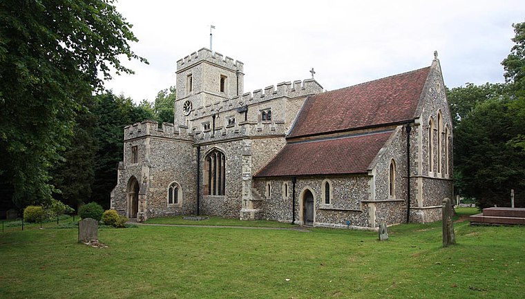
Photo: John Salmon, CC BY-SA 2.0.
The parish church of St Mary the Virgin in Walkern, Hertfordshire, dates from before the Norman Conquest and has been altered in the succeeding centuries. The nave retains at least one Anglo-Saxon wall. Church of St Mary the Virgin, Walkern is situated 1 mile northeast of Walkern Village History.
Benington High Wood
Forest

Photo: Dudley Miles, CC BY-SA 4.0.
Benington High Wood is a 20.7-hectare biological Site of Special Scientific Interest in Benington, Hertfordshire. The planning authority is East Hertfordshire District Council.
Chells Manor
Building

Photo: AnemoneProjectors, CC BY-SA 3.0.
Chells Manor is a building, which is situated 1¼ miles west of Walkern Village History.
Places in the Area
Nearby places include Aston End and Cromer.
Aston End
Village
Aston is a village and civil parish in the East Hertfordshire district of Hertfordshire, England. According to the 2001 census it had a population of 844, increasing to 871 at the 2011 Census.
Cromer
Village
Cromer is a hamlet in the civil parish of Ardeley, Hertfordshire, England. It is a small hamlet; however, it is noteworthy for possessing Hertfordshire's sole surviving post mill. Cromer is situated 2 miles northeast of Walkern Village History.
Stevenage

Photo: Traveler100, CC BY-SA 4.0.
Stevenage is a town of approximately 88,000 in the county of Hertfordshire, in the south east of England, around 32 miles north of central London. The town is well known for being the first ever 'new town'; new towns were a series of towns built near London after World War II.
Walkern Village History
- Type: Sign
- Categories: information and tourism
- Location: Walkern, East Hertfordshire District, Hertfordshire, East of England, England, United Kingdom, Britain and Ireland, Europe
- View on OpenStreetMap
Latitude
51.9129° or 51° 54′ 46″ northLongitude
-0.13218° or 0° 7′ 56″ westOpen location code
9C3XWV79+54OpenStreetMap ID
node 7798096075OpenStreetMap feature
tourism=information
This page is based on OpenStreetMap, Wikidata, and Wikimedia Commons.
We’d love your help improving our open data sources. Thank you for contributing.
Satellite Map
Discover Walkern Village History from above in high-definition satellite imagery.
Notable Places Nearby
Highlights include Walkern Sports & Community Centre and Walkern Primary School.
Nearby Places
Explore places such as Walkern Primary School and Cherry Tree Rise.
Hertfordshire: Must-Visit Destinations
Delve into St Albans, Watford, Stevenage, and Hertford.
Curious Places to Discover
Uncover intriguing places from every corner of the globe.
About Mapcarta. Data © OpenStreetMap contributors and available under the Open Database License". Text is available under the CC BY-SA 4.0 license, except for photos, directions, and the map. Photo: Wikimedia, CC0.