Cougars I and II
Cougars I and II is a work of art in Los Angeles, Southern California, California. Cougars I and II is situated nearby to the neighborhood Fox Hills, as well as near the bus station Culver City Transit Center.| Tap on a place to explore it |
Places of Interest Nearby
Highlights include Westfield Culver City and Holy Cross Cemetery.
Westfield Culver City
Shopping center
Westfield Culver City is a shopping mall in Culver City, California, owned by the Westfield Group. The mall features JCPenney, Macy's, Best Buy, Target, and Trader Joe's. Westfield Culver City is situated 1,200 feet southwest of Cougars I and II.
Holy Cross Cemetery
Cemetery
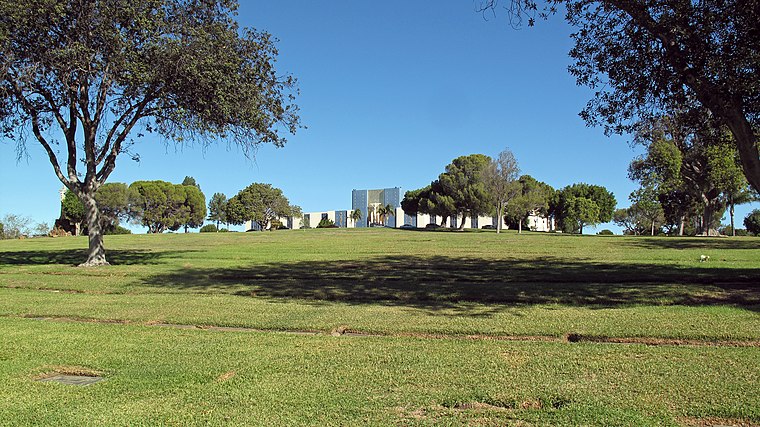
Photo: Downtowngal, CC BY-SA 4.0.
Holy Cross Cemetery is a Catholic cemetery and funeral home at 5835 West Slauson Avenue in Culver City, California, operated by the Los Angeles Archdiocese. Holy Cross Cemetery is situated 2,600 feet northeast of Cougars I and II.
Hillside Memorial Park Cemetery
Cemetery

Photo: ArthurDark, CC BY-SA 4.0.
Hillside Memorial Park Cemetery is a Jewish cemetery in Culver City, California, United States. Many Jewish people from the entertainment industry are buried there. Hillside Memorial Park Cemetery is situated 3,100 feet south of Cougars I and II.
Places in the Area
Nearby places include Fox Hills and Ladera Heights.
Fox Hills
Neighborhood
Fox Hills is a neighborhood of Culver City, California. It is roughly triangular in shape, bounded by West Slauson Avenue to the north, Centinela Avenue on the south, the San Diego Freeway to the southwest, and Canterbury Drive to the southeast.
Ladera Heights
Suburb
Ladera Heights is an unincorporated community and census-designated place in Los Angeles County, California, United States. The population was 6,634 at the 2020 census. Culver City lies to its west, the Baldwin Hills neighborhood to its north, the View Park–Windsor Hills community to its east, the Westchester neighborhood to its south and southwest and the city of Inglewood to its southeast.
Playa Vista
Quarter

Photo: Downtowngal, CC BY-SA 4.0.
Playa Vista is a neighborhood in the Westside area of Los Angeles, California, United States. The area was the headquarters of Hughes Aircraft Company from 1941 to 1985 and the site of the construction of the Hughes H-4 Hercules "Spruce Goose" aircraft. Playa Vista is situated 2 miles southwest of Cougars I and II.
Cougars I and II
- Type: Work of art
- Artwork type: sculpture
- Category: tourism
- Location: Los Angeles, Southern California, California, United States, North America
- View on OpenStreetMap
Latitude
33.98836° or 33° 59′ 18″ northLongitude
-118.39133° or 118° 23′ 29″ westOpen location code
8553XJQ5+8FOpenStreetMap ID
node 7838238248OpenStreetMap feature
tourism=artworkOpenStreetMap attribute
artwork_type=sculpture
This page is based on OpenStreetMap, Wikidata, and Wikimedia Commons.
We’d love your help improving our open data sources. Thank you for contributing.
Satellite Map
Discover Cougars I and II from above in high-definition satellite imagery.
Notable Places Nearby
Highlights include Culver City Transit Center and Dining Terrace.
Nearby Places
Explore places such as Chipotle and Century Housing.
Los Angeles: Must-Visit Destinations
Delve into Hollywood, San Gabriel Valley, San Fernando Valley, and Long Beach.
Curious Work Of Arts to Discover
Uncover intriguing work of arts from every corner of the globe.
About Mapcarta. Data © OpenStreetMap contributors and available under the Open Database License". Text is available under the CC BY-SA 4.0 license, except for photos, directions, and the map. Photo: Mfield, CC BY-SA 3.0.