Elegent Hair & Nails
Elegent Hair & Nails is a hairdresser in Reading, England. Elegent Hair & Nails is situated nearby to the health club 9Round, as well as near the theater building Sub89.| Tap on a place to explore it |
Places of Interest Nearby
Highlights include Reading Railway Station and Reading Minster.
Reading Railway Station
Railway station
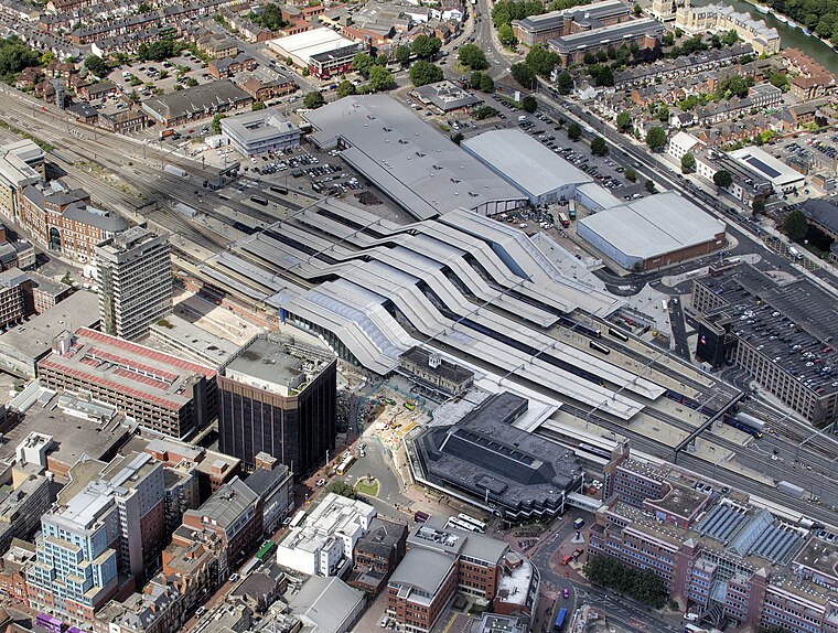
Photo: John Fielding, CC BY 2.0.
Reading railway station is a major transport hub in the town of Reading in Berkshire, England, it is 36 miles west of London Paddington. It is sited on the northern edge of the town centre, near to the main retail and commercial areas and the River Thames. Reading Railway Station is situated 1,100 feet north of Elegent Hair & Nails.
Reading Minster
Church

Photo: Ben Sutherland, CC BY 2.0.
Reading Minster, or the Minster Church of St Mary the Virgin, is the oldest ecclesiastical foundation in the town of Reading, Berkshire, England. Although eclipsed in importance by the later Reading Abbey, Reading Minster regained its status after the destruction of the Abbey and is now an Anglican parish church. Reading Minster is situated 700 feet south of Elegent Hair & Nails.
Reading Museum
Museum
 Reading Museum is a museum of the history of the town of Reading, in the English county of Berkshire, and the surrounding area. It is accommodated within Reading Town Hall, and contains galleries describing the history of Reading and its related industries… Reading Museum is situated 900 feet east of Elegent Hair & Nails.
Places in the Area
Nearby places include Coley and Caversham.
Coley
Suburb

Photo: Uli Harder, CC BY-SA 2.0.
Coley is an inner-town district near the centre of the town of Reading, in the English county of Berkshire. It is often referred to as Old Coley, to distinguish it from the adjacent, and much more recent, suburb of Coley Park.
Caversham
Suburb

Photo: Jystyn, Public domain.
Reading is a large, historic town in Berkshire in the South East of England. It is one of the largest towns without city status in the United Kingdom with just under 235,000 inhabitants.
Coley Park
Suburb

Photo: Graham Horn, CC BY-SA 2.0.
Coley Park is a suburban village to the south of the town of Reading in the English county of Berkshire. It is largely built on the country estate of the same name, surrounding Coley House.
Elegent Hair & Nails
- Type: Hairdresser
- Category: shop
- Location: Reading, England, United Kingdom, Britain and Ireland, Europe
- View on OpenStreetMap
Latitude
51.45643° or 51° 27′ 23″ northLongitude
-0.97353° or 0° 58′ 25″ westOpen location code
9C3XF24G+HHOpenStreetMap ID
node 7857127418OpenStreetMap feature
shop=hairdresser
This page is based on OpenStreetMap, Wikidata, and Wikimedia Commons.
We’d love your help improving our open data sources. Thank you for contributing.
Satellite Map
Discover Elegent Hair & Nails from above in high-definition satellite imagery.
Notable Places Nearby
Highlights include 9Round and Sub89.
Nearby Places
Explore places such as F4Fones and Fonetec.
England: Must-Visit Destinations
Delve into London, Manchester, Sheffield, and Leeds.
Curious Hairdressers to Discover
Uncover intriguing hairdressers from every corner of the globe.
About Mapcarta. Data © OpenStreetMap contributors and available under the Open Database License". Text is available under the CC BY-SA 4.0 license, except for photos, directions, and the map. Photo: Wikimedia, CC BY-SA 2.0.