el Cafè del Vallès
el Cafè del Vallès is a café in Ripollet, Barcelona, Catalonia. el Cafè del Vallès is situated nearby to the sports venue Pavelló Joan Creus, as well as near Plaça Joan Abad.| Tap on a place to explore it |
Places of Interest Nearby
Highlights include Molí d’en Rata Heritage Interpretation Centre and Teatre Auditori del Mercat Vell.
Molí d’en Rata Heritage Interpretation Centre
Museum

Photo: Wikimedia, CC BY-SA 3.0.
The Molí d'en Rata Heritage Interpretation Centre, in Ripollet, is a municipal facility dedicated to research into and the conservation, management and diffusion of the heritage of Ripollet. Molí d’en Rata Heritage Interpretation Centre is situated 350 metres southwest of el Cafè del Vallès.
Teatre Auditori del Mercat Vell
Theater building

Photo: Martinge636, CC BY-SA 4.0.
Teatre Auditori del Mercat Vell is a theater building, which is situated 460 metres south of el Cafè del Vallès.
Can Masachs
Town hall

Photo: Enric, CC BY-SA 4.0.
Can Masachs is a town hall, which is situated 540 metres southwest of el Cafè del Vallès.
Places in the Area
Nearby places include Ripollet and Sant Martí.
Ripollet
Town
 Ripollet is a municipality in the comarca of the Vallès Occidental in Catalonia, Spain. It is situated on the left bank of the Ripoll river. The town is served by the AP-7, C-58 and C-33 highways, the N-150 road and a RENFE railway line.
Sant Martí
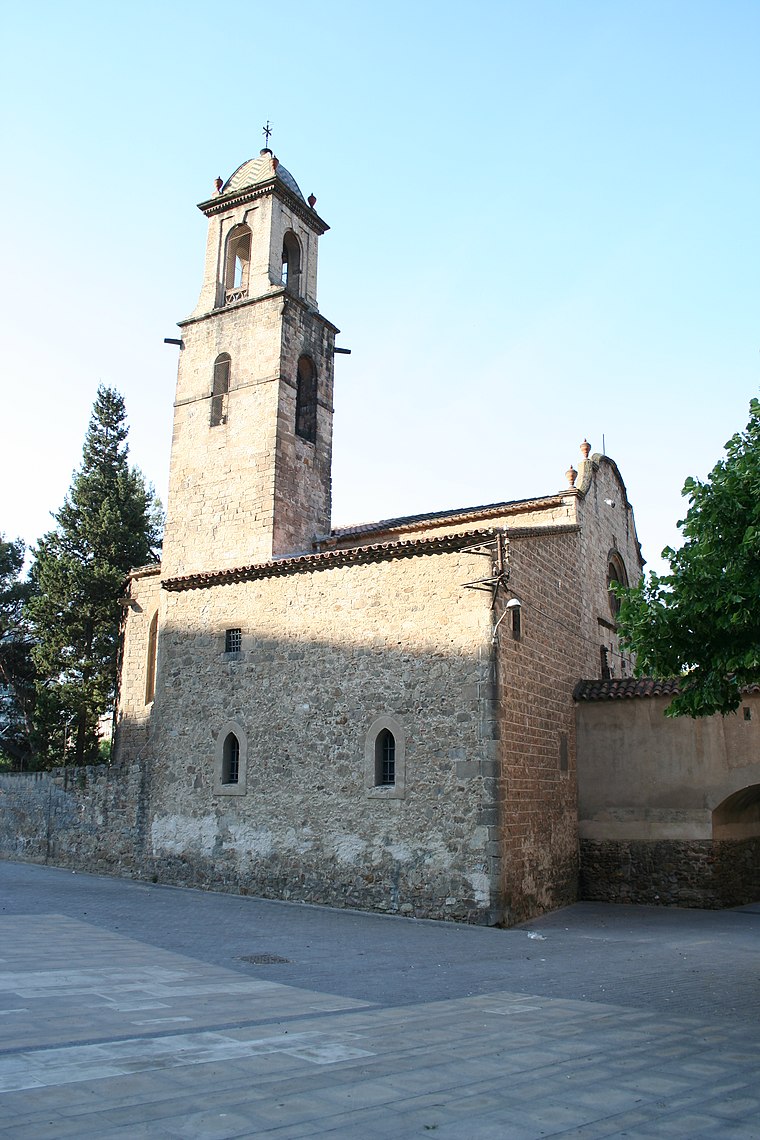
Photo: Wikimedia, CC BY-SA 3.0.
Sant Martí is a district in Barcelona which extends north of the Ciutat Vella. Developed from the former industrial areas of Poblenou, medieval district of Clot and suburbs of Sant Martí, it became a place of large-scale ambitious urban redevelopment.

el Cafè del Vallès
- Type: Café
- Location: Ripollet, Barcelona, Catalonia, Eastern Spain, Spain, Iberia, Europe
- View on OpenStreetMap
Latitude
41.5008° or 41° 30′ 3″ northLongitude
2.15659° or 2° 9′ 24″ eastOpen location code
8FH4G524+8JOpenStreetMap ID
node 7894239660OpenStreetMap feature
amenity=cafe
This page is based on OpenStreetMap, Wikidata, and Wikimedia Commons.
We’d love your help improving our open data sources. Thank you for contributing.
Satellite Map
Discover el Cafè del Vallès from above in high-definition satellite imagery.
Notable Places Nearby
Highlights include Pavelló Joan Creus and Plaça Joan Abad.
Nearby Places
Explore places such as Bar el Tapeo and Granja Lozvi.
Barcelona: Must-Visit Destinations
Delve into Barcelona, Malgrat de Mar, Terrassa, and Badalona.
Curious Cafés to Discover
Uncover intriguing cafés from every corner of the globe.
About Mapcarta. Data © OpenStreetMap contributors and available under the Open Database License". Text is available under the CC BY-SA 4.0 license, except for photos, directions, and the map. Photo: Alex Micheu Photography, CC BY-SA 3.0.