ملحمة الغرابلي
ملحمة الغرابلي is a restaurant in Amman Governorate, Jordan. ملحمة الغرابلي is situated nearby to the mosque مسجد العلا, as well as near the government office دائرة الافتاء.| Tap on a place to explore it |
Places of Interest Nearby
Highlights include King Abdullah I Mosque and Citadel Hill.
King Abdullah I Mosque
Mosque
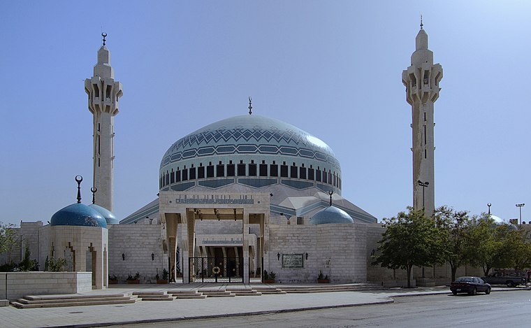
Photo: Berthold Werner, CC BY 3.0.
The King Abdullah I Mosque is a mosque, located in Amman, Jordan. Named in honour of Abdullah I, the mosque was built between 1982 and 1989 and is capped by a blue mosaic dome beneath which 3,000 Muslims may offer prayer. King Abdullah I Mosque is situated 3 km south of ملحمة الغرابلي.
Citadel Hill
 The Amman Citadel on Citadel Hill is an archaeological site on an L-shaped hill towering over Downtown Amman, in the central part of the capital of Jordan. Citadel Hill is situated 3½ km south of ملحمة الغرابلي.
Temple of Hercules
Ruins

Photo: لا روسا, CC BY-SA 3.0.
The Amman Citadel on Citadel Hill is an archaeological site on an L-shaped hill towering over Downtown Amman, in the central part of the capital of Jordan. Temple of Hercules is situated 4 km south of ملحمة الغرابلي.
Places in the Area
Nearby places include Jabal el-Hussein camp and Amman.
Jabal el-Hussein camp
Neighborhood
Jabal el-Hussein camp is one of the 10 officially recognized UNRWA Palestinian refugee camps in Jordan. It is located outside of the Abdali area district of Amman.
Amman

Photo: Berthold Werner, CC BY 3.0.
Amman is the capital and largest city of the Hashemite Kingdom of Jordan with a population of about 4 million as of 2020. Amman forms a great base for exploring the country and does, despite popular belief, hold a few items of interest to the traveler.
Al-Wehdat camp
Neighborhood

Photo: Wikimedia, CC BY-SA 3.0 igo.
Amman New Camp, usually known as the Al-Wehdat or Al-Wihdat camp, which is located in the Hay Al Awdah neighbourhood in southeast Amman, the capital city of Jordan, occupies a 0.48 km2. Al-Wehdat camp is situated 6 km south of ملحمة الغرابلي.
ملحمة الغرابلي
- Type: Restaurant
- Category: food
- Location: Amman Governorate, Jordan, Middle East, Asia
- View on OpenStreetMap
Latitude
31.98683° or 31° 59′ 13″ northLongitude
35.9241° or 35° 55′ 27″ eastOpen location code
8G3QXWPF+PJOpenStreetMap ID
node 8058474710OpenStreetMap feature
amenity=restaurant
This page is based on OpenStreetMap, Wikidata, and Wikimedia Commons.
We’d love your help improving our open data sources. Thank you for contributing.
Satellite Map
Discover ملحمة الغرابلي from above in high-definition satellite imagery.
Notable Places Nearby
Highlights include مسجد العلا and دائرة الافتاء.
Nearby Places
Explore places such as مطعم الوجبة الذهبية and (سرايا مول (كارفور.
Curious Restaurants to Discover
Uncover intriguing restaurants from every corner of the globe.
About Mapcarta. Data © OpenStreetMap contributors and available under the Open Database License". Text is available under the CC BY-SA 4.0 license, except for photos, directions, and the map. Photo: Wikimedia, CC0.