Noord, oostingang tunnel
Noord, oostingang tunnel is an adit in Maastricht, South Limburg, Limburg. Noord, oostingang tunnel is situated nearby to the cave Noord, ingang Ceulen, as well as near the pitch EPV.| Tap on a place to explore it |
Places of Interest Nearby
Highlights include Huis de Torentjes and Kiekoet.
Huis de Torentjes
Castle
 Huis de Torentjes is a castle, which is situated 310 metres east of Noord, oostingang tunnel.
Kiekoet
Scenic viewpoint
 Kiekoet is a scenic viewpoint, which is situated 510 metres southwest of Noord, oostingang tunnel.
Bonnefantenmuseum
Museum
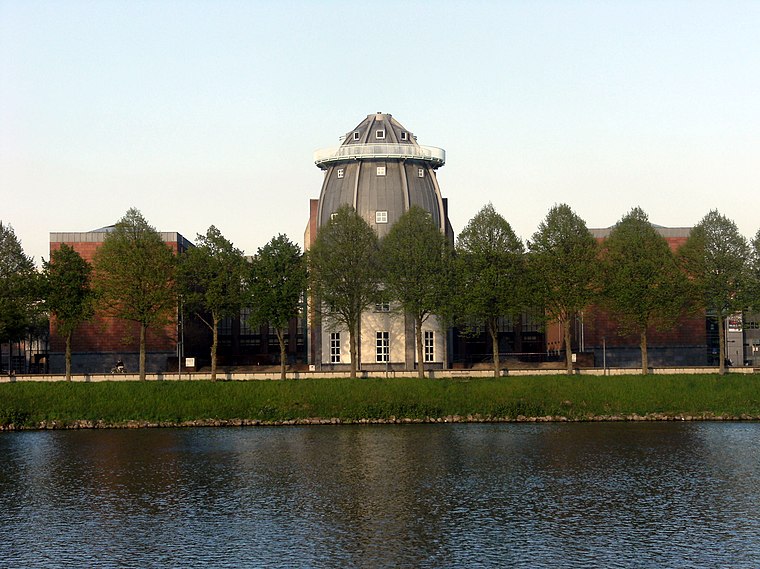
Photo: Mark Ahsmann, CC BY-SA 3.0.
The Bonnefanten Museum is a museum of historic, modern and contemporary art in Maastricht, Netherlands. Bonnefantenmuseum is situated 1¼ km northeast of Noord, oostingang tunnel.
Places in the Area
Nearby places include Villapark and Jekerkwartier.
Villapark
Neighborhood
Villapark is a neighbourhood of Maastricht, Netherlands, located in the city's southwestern part. It is a relatively affluent neighbourhood.
Jekerkwartier
Neighborhood
The Jekerkwartier is a neighbourhood in the old city centre of Maastricht, Limburg, Netherlands. It is named after the Jeker river that flows through the neighbourhood into the Meuse.

Noord, oostingang tunnel
- Type: Adit
- Category: industry
- Location: Maastricht, South Limburg, Limburg, Southern Netherlands, Netherlands, Benelux, Europe
- View on OpenStreetMap
Latitude
50.83271° or 50° 49′ 58″ northLongitude
5.68993° or 5° 41′ 24″ eastElevation
70 metres (230 feet)Open location code
9F27RMMQ+3XOpenStreetMap ID
node 809948425OpenStreetMap feature
man_made=adit
This page is based on OpenStreetMap, Wikidata, and Wikimedia Commons.
We’d love your help improving our open data sources. Thank you for contributing.
Satellite Map
Discover Noord, oostingang tunnel from above in high-definition satellite imagery.
Notable Places Nearby
Highlights include Noord, ingang Ceulen and EPV.
Nearby Places
Explore places such as EPV and Bar Verde.
South Limburg: Must-Visit Destinations
Delve into Heerlen, Kerkrade, Valkenburg aan de Geul, and Vaals.
Curious Adits to Discover
Uncover intriguing adits from every corner of the globe.
About Mapcarta. Data © OpenStreetMap contributors and available under the Open Database License". Text is available under the CC BY-SA 4.0 license, except for photos, directions, and the map. Photo: Bodoklecksel, CC BY-SA 3.0.