L’aiguillette 2
L’aiguillette 2 is a climbing site in Quebec, Canada. L’aiguillette 2 is situated nearby to the cliff Black and White, as well as near the climbing site 3D.| Tap on a place to explore it |
Places in the Area
Nearby places include Weir and Lac-des-Seize-Îles.
Weir
Village

Photo: P199, CC BY-SA 3.0.
Montcalm is a municipality in the Les Laurentides Regional County Municipality of Quebec southeast of Mont-Tremblant. The main population centre in Montcalm is the village of Weir.
Lac-des-Seize-Îles
Village
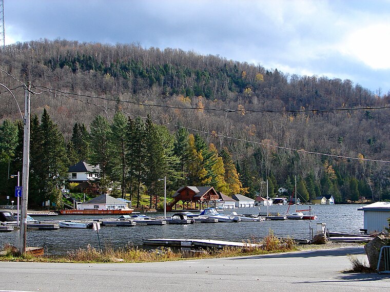
Photo: P199, CC BY-SA 3.0.
Lac-des-Seize-Îles is a village and municipality in the Laurentides region of Quebec, Canada, part of the Les Pays-d'en-Haut Regional County Municipality. Lac-des-Seize-Îles is situated 5 km southeast of L’aiguillette 2.
Arundel
Village

Photo: Wanditoast, Public domain.
Arundel is a township municipality in Quebec, Canada, located 18 kilometres south of Mont Tremblant. Arundel was settled by Scottish and Irish immigrants in the mid-19th century who established subsistence farming operations and worked the forests in winter. Arundel is situated 7 km west of L’aiguillette 2.
L’aiguillette 2
- Type: Climbing site
- Category: sports location
- Location: Quebec, Canada, North America
- View on OpenStreetMap
Latitude
45.94465° or 45° 56′ 41″ northLongitude
-74.52831° or 74° 31′ 42″ westOpen location code
87Q7WFVC+VMOpenStreetMap ID
node 8108083988OpenStreetMap feature
sport=climbing
This page is based on OpenStreetMap, Wikidata, and Wikimedia Commons.
We’d love your help improving our open data sources. Thank you for contributing.
Satellite Map
Discover L’aiguillette 2 from above in high-definition satellite imagery.
Notable Places Nearby
Highlights include Promenade du Centenaire and Promenade sur Mars.
Nearby Places
Explore places such as Tata Communications Laurentides Teleport and Sentiers Pédestres de Montcalm.
Quebec: Must-Visit Destinations
Delve into Montreal, Gaspé, Quebec City, and Percé.
Curious Climbing Sites to Discover
Uncover intriguing climbing sites from every corner of the globe.
About Mapcarta. Data © OpenStreetMap contributors and available under the Open Database License". Text is available under the CC BY-SA 4.0 license, except for photos, directions, and the map. Photo: Taxiarchos228, CC BY-SA 3.0.