Coupe à Blanc
Coupe à Blanc is a climbing site in Quebec, Canada. Coupe à Blanc is situated nearby to the climbing site Magyar, as well as near Marie 4 Poches.| Tap on a place to explore it |
Places in the Area
Nearby places include Weir and Lac-des-Seize-Îles.
Weir
Village

Photo: P199, CC BY-SA 3.0.
Montcalm is a municipality in the Les Laurentides Regional County Municipality of Quebec southeast of Mont-Tremblant. The main population centre in Montcalm is the village of Weir.
Lac-des-Seize-Îles
Village
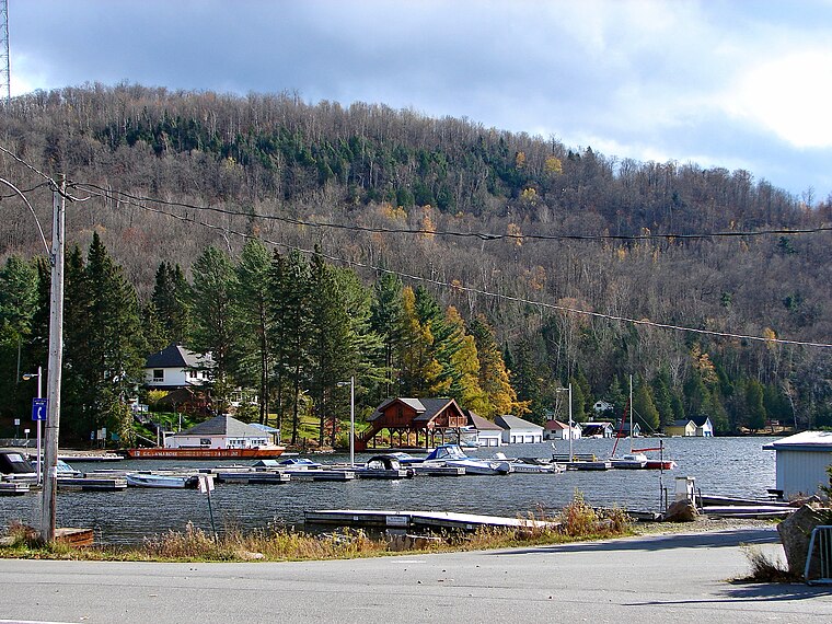
Photo: P199, CC BY-SA 3.0.
Lac-des-Seize-Îles is a village and municipality in the Laurentides region of Quebec, Canada, part of the Les Pays-d'en-Haut Regional County Municipality. Lac-des-Seize-Îles is situated 5 km southeast of Coupe à Blanc.
Arundel
Village

Photo: Wanditoast, Public domain.
Arundel is a township municipality in Quebec, Canada, located 18 kilometres south of Mont Tremblant. Arundel was settled by Scottish and Irish immigrants in the mid-19th century who established subsistence farming operations and worked the forests in winter. Arundel is situated 7 km west of Coupe à Blanc.
Coupe à Blanc
- Type: Climbing site
- Category: sports location
- Location: Quebec, Canada, North America
- View on OpenStreetMap
Latitude
45.94474° or 45° 56′ 41″ northLongitude
-74.5281° or 74° 31′ 41″ westOpen location code
87Q7WFVC+VQOpenStreetMap ID
node 8108084000OpenStreetMap feature
sport=climbing
This page is based on OpenStreetMap, Wikidata, and Wikimedia Commons.
We’d love your help improving our open data sources. Thank you for contributing.
Satellite Map
Discover Coupe à Blanc from above in high-definition satellite imagery.
Notable Places Nearby
Highlights include Clair de Femme and Marie 4 Poches.
Nearby Places
Explore places such as Tata Communications Laurentides Teleport and Sentiers Pédestres de Montcalm.
Quebec: Must-Visit Destinations
Delve into Montreal, Gaspé, Quebec City, and Percé.
Curious Climbing Sites to Discover
Uncover intriguing climbing sites from every corner of the globe.
About Mapcarta. Data © OpenStreetMap contributors and available under the Open Database License". Text is available under the CC BY-SA 4.0 license, except for photos, directions, and the map. Photo: Taxiarchos228, CC BY-SA 3.0.