‘t Patatje
‘t Patatje is a fast food restaurant in Hainaut, Wallonia which is located on Jean Dambrestraat. ‘t Patatje is situated nearby to the mosque Al Ansar-moskee, as well as near the park Koning van Spanje.| Tap on a place to explore it |
- Type: Fast food restaurant
- Cuisine: friture
- Address: Jean Dambrestraat 3
Places of Interest Nearby
Highlights include Sint-Lutgardiskerk and Ruisbroek railway station.
Sint-Lutgardiskerk
Church
 Sint-Lutgardiskerk is a church, which is situated 540 metres north of ‘t Patatje.
Ruisbroek railway station
Railway station
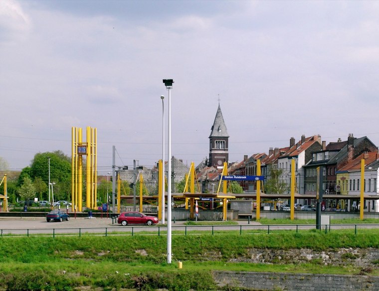
Photo: Koos Fernhout, CC BY-SA 2.0.
Ruisbroek railway station is situated 1¼ km east of ‘t Patatje.

Places in the Area
Nearby places include Ruisbroek and Negenmanneke.
Ruisbroek
Village
Photo: Koos Fernhout, CC BY-SA 2.0.
Ruisbroek is a village in the municipality of Sint-Pieters-Leeuw, in the Belgian province of Flemish Brabant. Previously a separate municipality, it became a deelgemeente of Sint-Pieters-Leeuw in 1977.
Sint-Pieters-Leeuw

Photo: Wouterhagens, CC BY-SA 4.0.
Sint-Pieters-Leeuw is a municipality in the province of Flemish Brabant, in the Flemish region of Belgium. The municipality comprises the towns of Oudenaken, Ruisbroek, Sint-Laureins-Berchem, Sint-Pieters-Leeuw proper and Vlezenbeek.
‘t Patatje
- Categories: food and restaurant
- Location: Hainaut, Wallonia, Belgium, Benelux, Europe
- View on OpenStreetMap
Latitude
50.78723° or 50° 47′ 14″ northLongitude
4.27974° or 4° 16′ 47″ eastOpen location code
9F26Q7PH+VVOpenStreetMap ID
node 8124720346OpenStreetMap feature
amenity=fast_foodOpenStreetMap attribute
cuisine=friture
This page is based on OpenStreetMap, Wikidata, and Wikimedia Commons.
We’d love your help improving our open data sources. Thank you for contributing.
Satellite Map
Discover ‘t Patatje from above in high-definition satellite imagery.
Places with the Same Name
Discover other places named “‘t Patatje”.
Notable Places Nearby
Highlights include Al Ansar-moskee and Koning van Spanje.
Nearby Places
Explore places such as Beobank and Peter Herman Tuinaanleg.
Hainaut: Must-Visit Destinations
Delve into Charleroi, Mons, Tournai, and La Louvière.
Curious Fast Food Restaurants to Discover
Uncover intriguing fast food restaurants from every corner of the globe.
About Mapcarta. Data © OpenStreetMap contributors and available under the Open Database License". Text is available under the CC BY-SA 4.0 license, except for photos, directions, and the map. Photo: Jean-Pol GRANDMONT, CC BY-SA 3.0.