Villach Oberwollanig
Villach Oberwollanig is a bus stop in Carinthia, Austria. Villach Oberwollanig is situated nearby to the athletics track KM 6 (draurad Marathon), as well as near the church Filialkirche Wollanig.| Tap on a place to explore it |
Places of Interest Nearby
Highlights include Filialkirche Wollanig and Draukraftwerk Villach.
Filialkirche Wollanig
Church

Photo: Johann Jaritz, CC BY-SA 3.0 at.
Filialkirche Wollanig is a church, which is situated 650 metres north of Villach Oberwollanig.
Draukraftwerk Villach
Power station
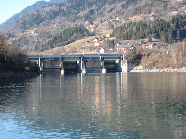
Photo: JJ55, CC BY-SA 3.0.
Draukraftwerk Villach is a power station, which is situated 1¼ km southeast of Villach Oberwollanig.
Auferstehungskirche
Church

Photo: Mefusbren69, Public domain.
Auferstehungskirche is a church, which is situated 2 km southeast of Villach Oberwollanig.
Places in the Area
Nearby places include Villach and Treffen am Ossiacher See.
Villach

Photo: Wikimedia, CC BY-SA 3.0.
Villach is a town in the Carinthia province of Austria. It has about 62,000 inhabitants. Villach is the second-largest city of Carinthia and a railway gateway to most parts of Austria as well as the Italian border.
Treffen am Ossiacher See
Village

Photo: Johann Jaritz, CC BY-SA 4.0.
Treffen am Ossiacher See is a market town in the district of Villach-Land in Carinthia in south-central Austria. Treffen am Ossiacher See is situated 4½ km northeast of Villach Oberwollanig.
Landskron
Suburb

Photo: Bwag, CC BY-SA 4.0.
Landskron is a suburb, which is situated 5 km east of Villach Oberwollanig.
Villach Oberwollanig
- Type: Bus stop
- Categories: transport stop and transportation
- Location: Carinthia, Austria, Central Europe, Europe
- View on OpenStreetMap
Latitude
46.63826° or 46° 38′ 18″ northLongitude
13.81655° or 13° 48′ 60″ eastOpen location code
8FRMJRQ8+8JOpenStreetMap ID
node 8138749388OpenStreetMap feature
highway=bus_stopOpenStreetMap feature
public_transport=stop_position
This page is based on OpenStreetMap, Wikidata, and Wikimedia Commons.
We’d love your help improving our open data sources. Thank you for contributing.
Satellite Map
Discover Villach Oberwollanig from above in high-definition satellite imagery.
Notable Places Nearby
Highlights include KM 6 (draurad Marathon) and Feuerwehr Oberwollanig.
Nearby Places
Explore places such as Villach Oberwollanig and The Other Place.
Carinthia: Must-Visit Destinations
Delve into Klagenfurt, Villach, Wörthersee, and Spittal an der Drau.
Curious Bus Stops to Discover
Uncover intriguing bus stops from every corner of the globe.
About Mapcarta. Data © OpenStreetMap contributors and available under the Open Database License". Text is available under the CC BY-SA 4.0 license, except for photos, directions, and the map. Photo: Wikimedia, CC BY-SA 3.0.