Taala Supermarket
Taala Supermarket is a newsagent in Wolverhampton, England. Taala Supermarket is situated nearby to Wolverhampton Post Office, as well as near the recreation area Hog’s Head Beer Garden.| Tap on a place to explore it |
Places of Interest Nearby
Highlights include Molineux Stadium and Grand Theatre.
Molineux Stadium
Stadium
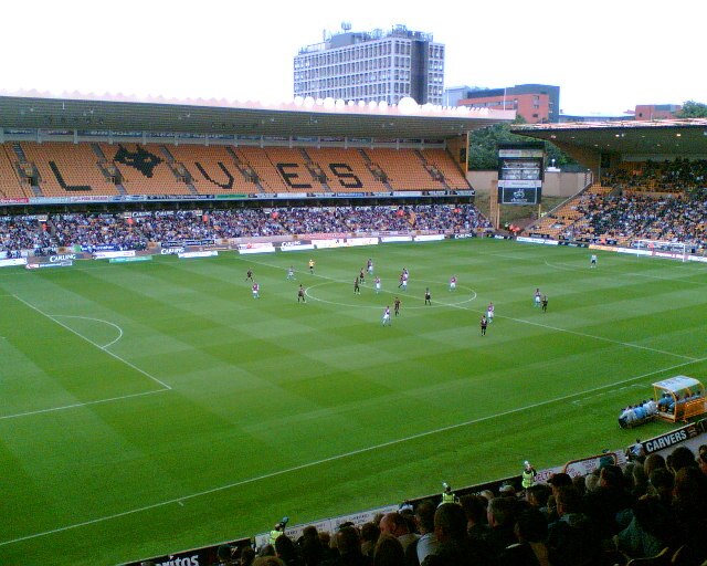
Photo: John Nickolls, CC BY-SA 2.0.
Molineux Stadium is a football stadium situated in Wolverhampton, West Midlands, England. It has been the home ground of Premier League club Wolverhampton Wanderers since 1889. Molineux Stadium is situated 1,600 feet northwest of Taala Supermarket.
Grand Theatre
Theater building

Photo: Gordon Griffiths, CC BY-SA 2.0.
The Wolverhampton Grand Theatre, commonly known as The Grand, is a theatre located on Lichfield Street, Wolverhampton. The theatre was designed in 1894 by Architect Charles J. Phipps. It is a Grade II Listed Building with a seating capacity of 1200. Grand Theatre is situated 370 feet southeast of Taala Supermarket.
Wolverhampton Art Gallery
Museum
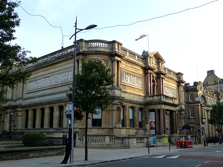
Photo: Æthelred, CC BY-SA 3.0.
Wolverhampton Art Gallery is located in Wolverhampton, England. The building was funded and constructed by local contractor Philip Horsman, and built on land provided by the municipal authority. It opened in May 1884. Wolverhampton Art Gallery is situated 490 feet west of Taala Supermarket.
Places in the Area
Nearby places include Springfield and All Saints.
Springfield
Quarter

Photo: John M, CC BY-SA 2.0.
Springfield is an area of Wolverhampton, England immediately north east of the city centre. It was the home of the Springfield Brewery from 1873 until 1991.
All Saints
Quarter
All Saints is an inner city area of Wolverhampton, West Midlands, England. It is situated immediately to the south-east of the city centre, in the city council's Ettingshall ward.
Low Hill
Suburb
Low Hill is in Wolverhampton, West Midlands, England. It is north-east of Wolverhampton city centre, within the Bushbury South and Low Hill ward. Low Hill is situated 1½ miles north of Taala Supermarket.
Taala Supermarket
- Type: Newsagent
- Category: shop
- Location: Wolverhampton, England, United Kingdom, Britain and Ireland, Europe
- View on OpenStreetMap
Latitude
52.58733° or 52° 35′ 14″ northLongitude
-2.12494° or 2° 7′ 30″ westOpen location code
9C4VHVPG+W2OpenStreetMap ID
node 8158581366OpenStreetMap feature
shop=newsagent
This page is based on OpenStreetMap, Wikidata, and Wikimedia Commons.
We’d love your help improving our open data sources. Thank you for contributing.
Satellite Map
Discover Taala Supermarket from above in high-definition satellite imagery.
Notable Places Nearby
Highlights include Wolverhampton Post Office and Hog’s Head Beer Garden.
Nearby Places
Explore places such as My Angel and AV.
England: Must-Visit Destinations
Delve into London, Manchester, Sheffield, and Leeds.
Curious Newsagents to Discover
Uncover intriguing newsagents from every corner of the globe.
About Mapcarta. Data © OpenStreetMap contributors and available under the Open Database License". Text is available under the CC BY-SA 4.0 license, except for photos, directions, and the map. Photo: Mariegriffiths, CC BY-SA 4.0.