Hospital del Jueguete
Hospital del Jueguete is a memorial in Madrid, Community of Madrid. Hospital del Jueguete is situated nearby to the quarter Pacífico, as well as near the health club Gimnasio F. del Yerro.| Tap on a place to explore it |
Places of Interest Nearby
Highlights include Platform 0 and Royal Tapestry Factory.
Platform 0
Museum
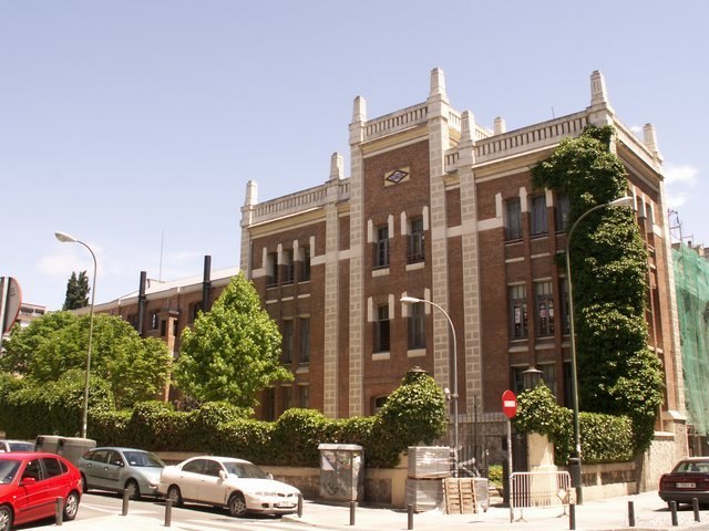
Photo: Wikimedia, Public domain.
Platform 0 is an exhibition project of the Madrid Metro consisting of the historical Estación de Chamberí, which has been out of service since 1966, and the Motores de Pacífico generator building. Platform 0 is situated 280 metres east of Hospital del Jueguete.
Royal Tapestry Factory
Museum
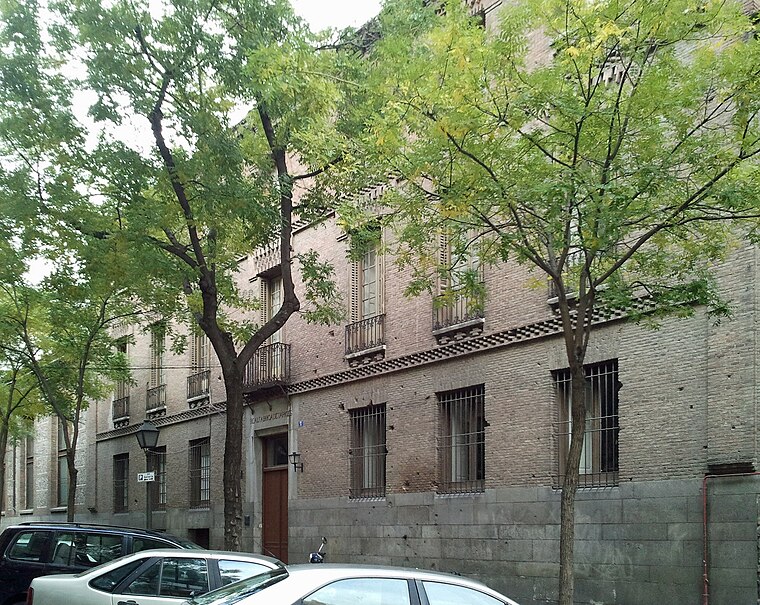
Photo: Jalcaire, CC BY-SA 3.0.
The Royal Tapestry Factory is a factory making tapestries in Madrid, Spain, which was founded in 1720 and is still in operation. Royal Tapestry Factory is situated 480 metres northwest of Hospital del Jueguete.
Iglesia de Nuestra Señora de la Paz
Church

Photo: Zaqarbal, CC BY-SA 3.0 es.
Iglesia de Nuestra Señora de la Paz is a church, which is situated 170 metres northeast of Hospital del Jueguete.
Places in the Area
Nearby places include Pacífico and Atocha.
Pacífico
Quarter

Photo: Zaqarbal, CC BY-SA 3.0 es.
Pacífico is an administrative neighborhood of Madrid belonging to the district of Retiro.
Atocha
Quarter
 Atocha is an administrative neighborhood of Madrid belonging to the district of Arganzuela.
Adelfas
Quarter

Photo: Wikimedia, CC BY-SA 3.0.
Adelfas is an administrative neighborhood in Madrid of the Retiro district. It is located in the extreme south of the district, so it only delimits with 3 of the 5 neighborhoods of the district: Pacífico to the west, Niño Jesús to the east and Estrella to the northeast.
Hospital del Jueguete
- Type: Memorial
- Inscription: “En este edificio se encontraba el HOSPITAL DEL JUGUETE donde desde 1945 se fabricaron, inventaron y restauraron innumerables juguetes, preservando la ilusión de múltiples generaciones”
- Category: historic site
- Location: Madrid, Madrid, Community of Madrid, Central Spain, Spain, Iberia, Europe
- View on OpenStreetMap
Latitude
40.4039° or 40° 24′ 14″ northLongitude
-3.67733° or 3° 40′ 38″ westInception
2019Open location code
8CGRC83F+H3OpenStreetMap ID
node 8177122323OpenStreetMap feature
historic=memorial
This page is based on OpenStreetMap, Wikidata, and Wikimedia Commons.
We’d love your help improving our open data sources. Thank you for contributing.
Satellite Map
Discover Hospital del Jueguete from above in high-definition satellite imagery.
Notable Places Nearby
Highlights include Mercado de Pacífico and Gimnasio F. del Yerro.
Nearby Places
Explore places such as Alimentación and The Retro bar.
Madrid: Must-Visit Destinations
Delve into Sol-Letras-Lavapiés, Salamanca, Retiro-Paseo del Arte, and Chamberí-Castellana.
Curious Memorials to Discover
Uncover intriguing memorials from every corner of the globe.
About Mapcarta. Data © OpenStreetMap contributors and available under the Open Database License". Text is available under the CC BY-SA 4.0 license, except for photos, directions, and the map. Photo: DonPaolo, CC BY-SA 3.0.