Alto del Biscardón
Alto del Biscardón is a peak in Cardeñajimeno, Burgos, Castile and León and has an elevation of 974 metres. Alto del Biscardón is situated nearby to the locality Doradillo, as well as near Tres Fuentes.| Tap on a place to explore it |
Places of Interest
Highlights include Burgos Villafria Airport and Iglesia del Salvador.
Burgos Villafria Airport
Aerodrome
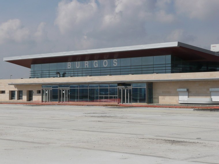
Photo: Forjamus, Public domain.
Burgos Airport, also known as Villafría, is an airport located 4 kilometres east of the historic center of Burgos, a city in Spain. The company Aeronova has its maintenance headquarters in Villafría.


Places in the Area
Nearby places include Burgos and Gamonal.
Burgos

Photo: Jardoz, CC BY-SA 3.0.
Burgos is a city in Castile and León in northern Spain, with a population of 175,000 in 2023. It's best known for its cathedral, a UNESCO World Heritage site and stopover on the Camino de Santiago pilgrimage trail.

Cardeñajimeno
Village
 Cardeñajimeno is a municipality located in the province of Burgos, Castile and León, Spain. According to the 2004 census, the municipality has a population of 612 inhabitants.
Alto del Biscardón
- Type: Peak with an elevation of 974 metres
- Category: landform
- Location: Cardeñajimeno, Burgos, Castile and León, Central Spain, Spain, Iberia, Europe
- View on OpenStreetMap
Latitude
42.3191° or 42° 19′ 9″ northLongitude
-3.6285° or 3° 37′ 43″ westElevation
974 metres (3,196 feet)Open location code
8CJR899C+JHOpenStreetMap ID
node 8178281252OpenStreetMap feature
natural=peak
This page is based on OpenStreetMap, Wikidata, and Wikimedia Commons.
We’d love your help improving our open data sources. Thank you for contributing.
Satellite Map
Discover Alto del Biscardón from above in high-definition satellite imagery.
Localities in the Area
Explore places such as Doradillo and Portillo de los Lobos.
Notable Places Nearby
Highlights include Fuente Doradillo and Fuente la Sierpe.
Castile and León: Must-Visit Destinations
Delve into Valladolid, Salamanca, Segovia, and León.
Curious Peaks to Discover
Uncover intriguing peaks from every corner of the globe.
About Mapcarta. Data © OpenStreetMap contributors and available under the Open Database License". Text is available under the CC BY-SA 4.0 license, except for photos, directions, and the map. Photo: Choniron, CC BY-SA 3.0 es.